![]()
![]()
![]()
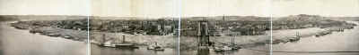
This was taken from the top of the Suspension Bridge's Covington tower on November 11, 1908
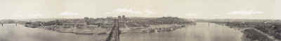
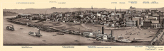
These images were shot from the Covington side where the Licking River enters the Ohio. This was taken on 6/11/1914.
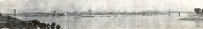
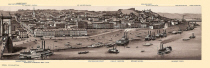
Two version of the same image. Shot from the top of the Suspension Bridge's Covington tower. The cables have been strung but the bed has not been laid making the date late 1865 to 1866. The 2nd image is a smaller, cleaned-up, version.
![]()
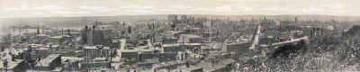
As you can see from the condition, this is one of the oldest ones. You can see the cables have been strung for the Suspension Bridge so that would place the date for this panorama around late 1865 to 1866.
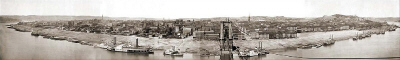
This real photo is related to some of the cards seen on the previous page. It was taken from Mount Adams.
![]()
This one is HUGE when expanded, you will have to scroll back & forth and up & down to see it all. It's worth all the trouble. This sequence of photographs is extremely old, believe it or not it was taken in 1848. The clarity of the images is amazing.
This one I had to scan in two parts. It is from a small souvenir book (3.25" x 5") put out by E. N. Freshman & Bros. Advertising agents for newspapers. I have never seen this image anywhere before.
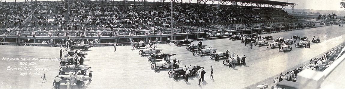
The next three pictures show a race that was held
at the Cincinnati Motor Speedway. Built in Sharonville on 640 acres in 1916 it
was a 2 mile high banked oval made of wood. The so-called "board
track", built by Harry Hake, had 17 degree banked turns with 33
degrees at the top, and had 6 degree banked straightaways that were 70' wide. The
Indianapolis Motor Speedway, which ran its first 500 mile race in 1911,
cancelled its 1917 schedule because of WW I and was briefly used as an airplane
repair facility. Cincinnati Motor Speedway applied for the May 30 race date and
was awarded a 250 mile race. That race was won by Louis Chevrolet, who had
designed passenger cars before selling his patent to General Motors.
Unofficially, the number of people attending that race was estimated by the old
Commercial-Tribune at 65,000 which makes it one of the largest crowds to attend
a sporting event in Cincinnati history. Chevrolet averaged 102 MPH, and collected $12,500
prize money, a large sum in those days.
The wooden boards did not weather well outdoors, and the track
closed in December of 1919. The last event held there was a 48 hour endurance
run for Essex autos in December. The site is currently a U.S. Post Office among
other businesses. The track lumber was shipped to Chillicothe to be used in the
construction of Camp Sherman during WW I.
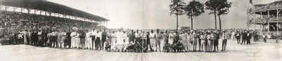
The three cards below show, what I believe to be, the first race
held at the new track. It was the 300 mile 1st International Sweepstakes Race
that was held on September 4, 1916. The winner was John Aitken who averaged
97.059 MPH. The crowd was estimated to be be 27,000 to 30,000. There was one
fatality in the race, a mechanic Bert Shields was riding with driver Gil
Anderson and was killed during an accident on lap 84. The driver was seriously
injured.
![]()
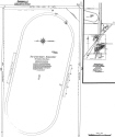
Sanborn
Map
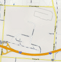
Google Map of Location