![]()
![]()
FAIRMOUNT VALLEY
HARRISON
LOVELAND
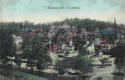
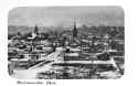
MADISONVILLE
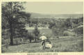
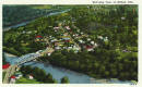
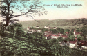
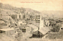
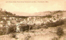
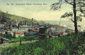
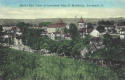
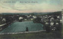
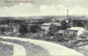
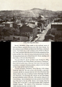
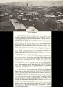
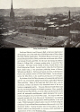
MILFORD
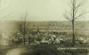
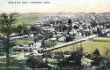
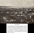
Glimpse Of Milford
1
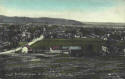
Glimpse Of Milford
2
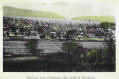
Glimpse Of Milford 3
LICK RUN VALLEY
READING SEDAMSVILLE
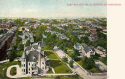
WALNUT HILLS


Looking
East
Day
Version
Night Version
Photograph used for last 2
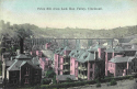
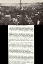
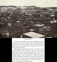
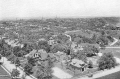
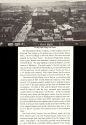
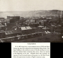
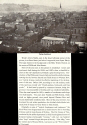
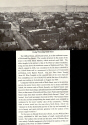
1866 CINCINNATI BIRD'S-EYE VIEW
The following section is of a rarely seen panorama of Cincinnati that was taken in 1866. This is the earliest panoramic photograph showing the details of the heart of the city. Of course the 1848 daguerreotype, seen on the Panoramas Page, of the waterfront was the first. J. W. Winder, a local photographer, took these photographs from the top of Mozart Hall which was just south of Sixth and Vine Streets (where later the Grand Theater would stand). The panorama was first seen at Winder's Fourth Street Studio on July 28, 1866. The map below shows what area each photograph is viewing. The explanations that accompany each image was written 30-40 years ago so the buildings that are mentioned, for the most part, no longer stand. You will have to insert today's structures into the explanation. There is no easy way to show this panorama but this was the best I could come up with. I believe the trouble you will have will be worth it.
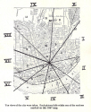
Panorama sections
Section
I
Section
II
Section
III
Section IV
Section
V
Section
VI
Section
VII
Section VIII