![]()
![]()
![]()
![]()
![]()
There were 5 different inclines in Cincinnati. The Main Street Incline (also known as the Lookout incline or the Mt. Auburn incline) opened in 1871 and closed in 1898 so there are no cards (that I know of) made. The Mt. Adams Incline (also known as The Eden Park and The Highland Incline) opened in 1876 and was the last one to close in 1948. The Price Hill Incline was the only double incline. One for freight and one for passengers. The passenger plane opened in 1874 and closed in 1943. The freight plane opened in 1877 and closed in 1929. The Fairview Incline opened in 1892 and closed in 1923, the shortest operating span of any incline. The Bellevue Incline (also known as the Clifton Incline, the Elm Street Incline, and the Ohio Incline) opened in 1876 and closed in 1926.
![]()
Incline Facts
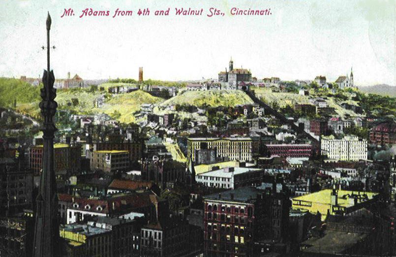
MOUNT ADAMS INCLINE


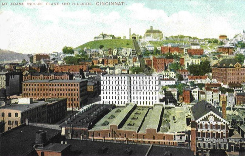
Map showing inclines route
2 Photographs
after demolition
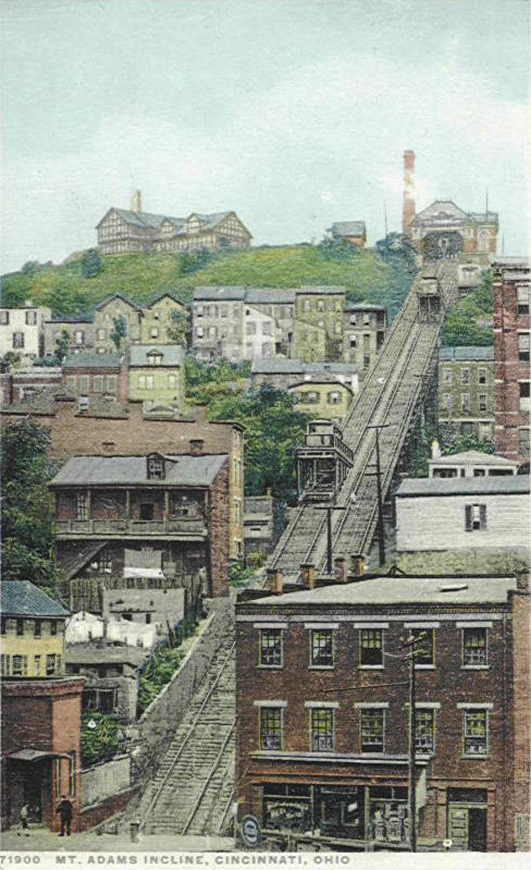
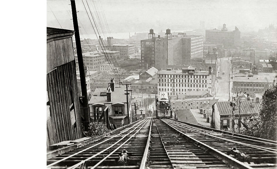
The 4th image below is from the Cincinnati Street Railway monthly magazine for the railway's employees. This is the June 1930 issue. It is looking toward the Ohio River on Oregon Street. There are five streets to remember in relation to the Mt. Adams Incline, they are from the bottom to the top, Lock Street, Kilgour Street, Baum Street, Oregon Street, and at the top, Ida Street.


Three views from the top of the incline

THE ABOVE IMAGES ARE NOT POSTCARDS.


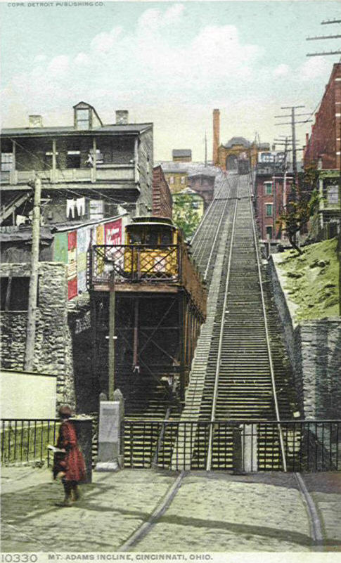


Postcards and photo they were made from

Not Often Seen Image


 *
*
To encourage tourism and ridership of the various inclines in the Cincinnati area 4 of the five inclines had elaborate complexes at the top. The only incline that did not have a resort at the top was the Fairview Incline. The 6 images below are of the very popular Highland House which was located right next to the Mount Adams Incline. The Highland House was not owned by the railway company but its existence greatly increased the inclines business. On busy nights its beer garden could accommodate as many as 8,000 patrons. This fabulous structure was razed in 1895 in great part due to falling victim to the Sunday closing law, its own increasingly rowdy reputation and competition from all the other retreats around the city. It was replaced by the Sterling Glass Company (see Mount Adams Page) in 1902, and then by the still-standing Highland Towers in 1964. In its heyday the Highland House contained a dining hall and pool rooms on the ground floor. On the 2nd floor there was a balcony for private parties. On the east side there was a canopied summer garden and a large wood pavilion in the rear where concerts and light operas were presented. In the basement were bowling alleys, a wine cellar, and a beer bottling plant. Near the main house was The Belvedere, a huge concert hall. The 1st image below is from the top of the incline with the Mt. Adams Incline on the right and the Highland House, the 2nd shows the interior of the Highland House. The 2nd row contains various views of this entertainment center.
These are not postcards


Views after inclines closing in 1948
Incline operator cabin
The first image above is from the inside looking back to Mount Adams, the ladder was for the operator to get to the control room that sat 10' above the floor of the head house. A trip took 2 minutes & 20 seconds to complete and was done 6 times every hour, 19 hours a day. So even though the operator had one of the best views in the city, he had little time to enjoy it as he had to concentrate on the tracks and the movement of two trucks simultaneously. The last photograph above shows operator Foster Carroll in 1948. His left hand is on the throttle, the two foot pedals operated the winding drum brakes. He had to use all his weight when using them as they were not power brakes. There was a red warning light that would indicate trouble with the machinery. The tracks on the right side in the 2nd image were for cars with loads of coal that were used in the boiler house.


1876
1936 Diagram
of Machinery
Safety
Sheave
Winding Drum
The first image above shows the changes that occurred after 60 years of operation. The second image is a diagram of the inclines machinery. The next image shows the safety sheaves. A single safety cable was wrapped around these two wheels and each end was attached to one of the platforms or "trucks" which counter balanced them. a licensed engineer was required to be on the job whenever the incline was in operation. A full crew consisted of an operator, an engineer, a fireman, two gatemen, and two carpenters. The gatemen's job was to take the tickets from the passengers in the waiting room and then escort them onto the lift. He then signaled the operator that the car was on the lift, and the gate was closed by ringing two bells. The operator responded by ringing two bells of his own. The gate could not be opened for any reason after the last bell had rung. The last non-postcard image shows one of two winding drums used. These were the drums that raised and lowered the two platforms. Both of these objects were beneath the floor of the top station (see diagram).

Dec. 1, 1940 pass to ride almost any car needed to get to, and use, the Mt. Adams Incline.

1920 Fare Chart

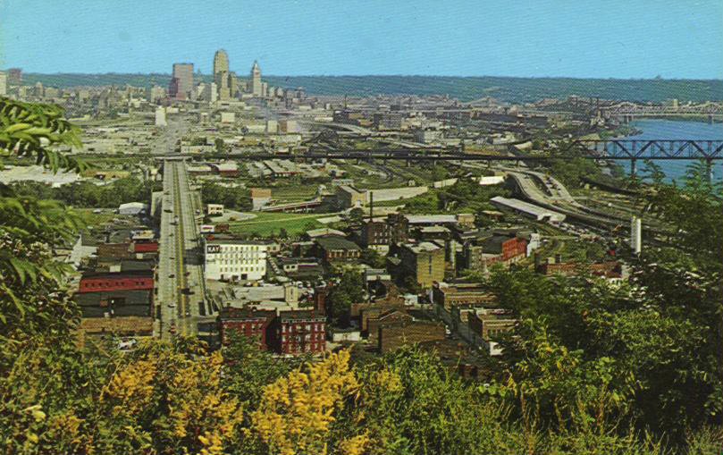
Present Day Photograph
The overhead view above clearly shows where the Incline was located, in the lower center of the image.
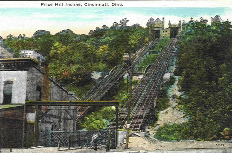
PRICE HILL INCLINE

Early Lithograph


Would you believe these two
cards Telephone lines prove
Rarely seen card
are the same image? Both
retouched this image is
original.
It is not the same image
as the other two.


View seen from top of incline
These are not postcards


1930 Image
1888
Image
1906 Charges
FOR MORE INCLINE
CARDS: ![]()
