![]()
![]()
![]()
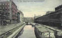
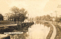
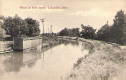
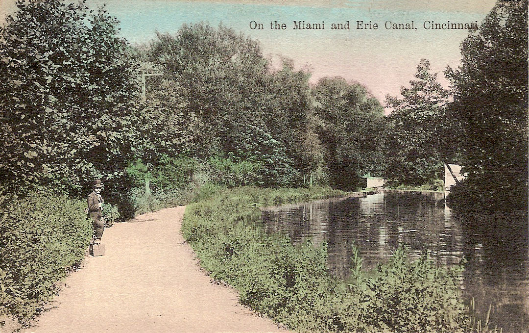
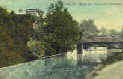
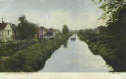
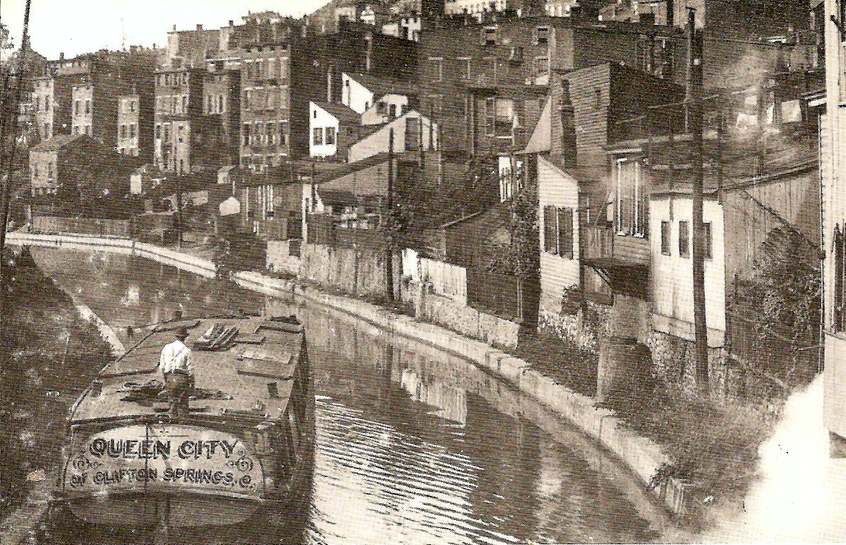
The Miami and Erie Canal, begun in
1825, connected Cincinnati with the Great Lakes. The first boats used portions
of the canal in 1827, and by 1845 boats carrying ice, sand, pork, lumber and all
sorts of cargo, came down the canal. Many of the major industries of the day
moved to locations along the waterway. The ice would be carried in double hulled
boats that were insulated. The ice would be packed in sawdust. In the winter,
water would be diverted from the canal into flat fields enclosed with three to
four foot dirt walls to form ice ponds. Once a pond was frozen, the ice would be
cut and stored in warehouses built for that purpose.
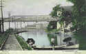
Canal boats were pulled by mules using a towpath
usually maintaining a speed of three or four miles an hour, there was a 10 miles
an hour speed limit because the water would spill up and over the berm. Toward the end of
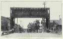
the century trucks called "electric mules" were used. You can see the
tracks they ran on in a couple of these cards. The usefulness of the canals by the end of the
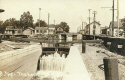
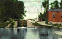
century were almost nil due of course to the railroads. There were many locks along this
waterway (guess how Lockland got its name).
There was one other canal that entered
Cincinnati, The Whitewater Canal. It traveled from Indiana to Cincinnati along
the Ohio River next to where river road is and it terminated at 3rd and Central.
It crossed the Mill Creek by an Aqueduct.
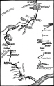
The first non postcard image shows the layout of a typical canal
boat and the second one shows the route of the canal thru the Cincinnati area to
the Ohio River.
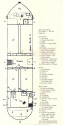
Canal Boat Layout
LOCKLAND
*
 *
*
No location
given
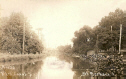
Mill Creek
Valley
*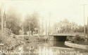
Carthage Pike Bridge
St, Bernard
St. Bernard
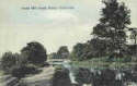
Both Real Photos
Near
Cincinnati
Near
Cincinnati
Brighton
Elmwood Place &
Carthage
North from Mohawk
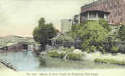
The postcard above is near the Ravine Street exit on Central Parkway.
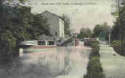
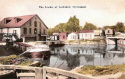
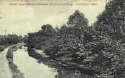
You will see 3 cards below of water going down a spillway. On July 1, 1919, the entire flow of the Miami and Erie Canal was directed over this spillway into the Mill Creek. This spillway was directly across from Spring Grove Cemetery. This had to be done because the Mill Creek had become, basically, a toilet and the extra water was needed to flush it.

Not a postcard
Route of canal in city.
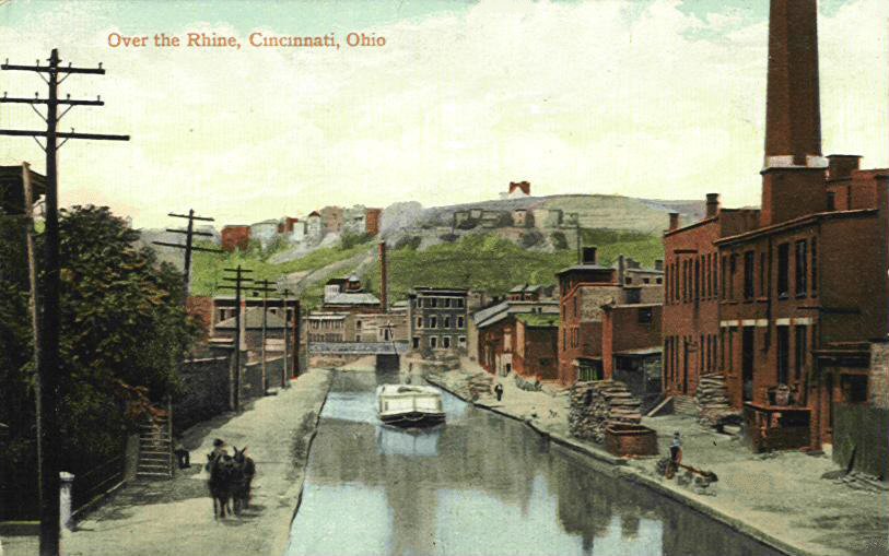

Over The
Rhine
The 2nd image above is a photograph.
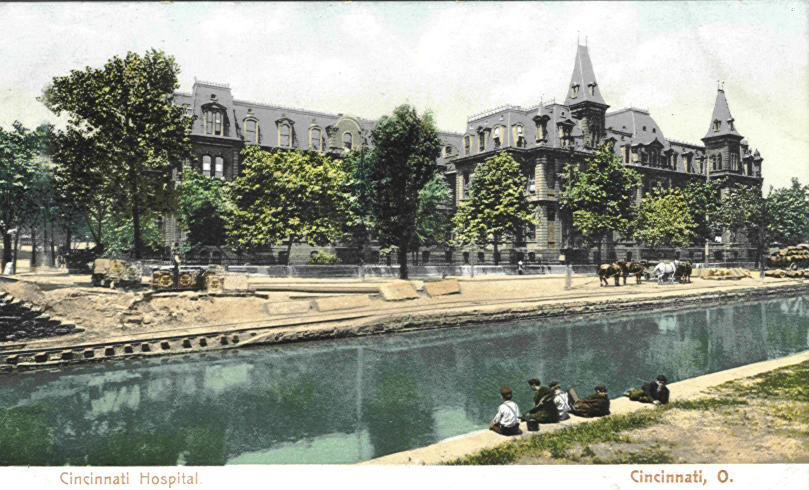
City Hospital across from Music Hall
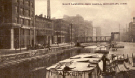
These are not postcards
Two views of Central Parkway looking East
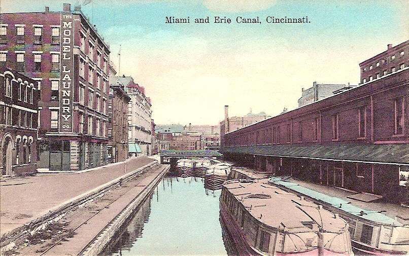
The third non-postcard image above show the canal as it looked in 1875. This scene is where the canal turned west, to what is today Central Parkway. Plum Street is straight ahead. You can see the spire of St. Peters Church on the right. Plum Street Temple is on the left in the distance. The 4th image is the same area only looking in the other direction. The City Hospital is in the center and on its left is the T.T. Haydock Carriage Co.. Across the canal Music Hall's spires can just be seen behind the building on the right.
LOOKING EAST TO MT. ADAMS
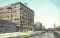
The card above says it is a view of The Advertisers Block at 109-121 W. Canal. This is actually the tall building on the left. It was called that because the tenants in that structure were all involved, one way or another, in the advertising business. The bottom floor contained The Rapid Electrotype Co. it claimed to be the largest electrotype plant in the world (1910). They were one of the largest distributors of advertising plates. The middle floors were occupied by The George H. Jung Co.. They were importers, creators and manufacturers of Calendars, Hangers, Fans and novelties, all for advertising purposes. The top floor was the premises of The Cincinnati Process Engraving Co. They were photo-engravers for the advertising community.
Alms and Doepke
Co.
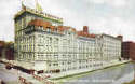
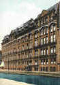
In 1865 Frederick and William Alms joined with
William F Doepke to create the Alms & Doepke department store on Main
Street. In 1878, the store moved to a much larger building in a choice location
on the North side of the Miami Erie Canal at Main St. By the turn of the
century, Alms & Doepke were the second largest mercantile establishment west
of New York City. With the decline of the Over-The-Rhine which was the major
source of customers for the store, profits fell and the store closed April 3,
1954. The building now houses local government and court system offices.
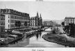
The canal from Main St. to the Ohio river is rather complicated.
The difference in elevation from Main St. to the low water mark of the Ohio is
110 feet. In 1830 excavation was begun to connect the Ohio river to Main St. By
1831 the canal had been extended from Main across Deercreek river by means of a
large culvert. By 1834 there was a total of 32 locks connecting Main St. with
the Ohio river. This obviously made it extremely difficult and time consuming to
traverse the relatively short distance. They then replaced these small locks
with 10 larger locks with a lift of 11 feet. This all took place along where
Eggleston Ave. is now. This was still so time consuming and uneconomical that in 1870
the mile long stretch along Eggleston Ave. was paved over and the canal water drained to the Ohio
thru a sewer.
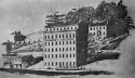
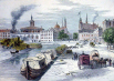
Canal in
1840
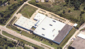
Atkins & Pearce Today
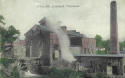
The 1st image above is the earliest known
industrial canal boat picture known. Pearce's factory was located at what was
the northeast corner of 5th Street and Eggleston Avenue. On the far left can be
seen one of the locks and lock building. The locks at this time had a drop of
10' and the overflow can be seen. At the lower left of the Pearce building can
be seen the semicircular top to a tunnel that allowed water to flow thru the
factory and this powered the machinery in the plant with the water returning to
the canal at the other end of the building. The company used this until 1919
when the water stopped running.
The history of this company began in 1817 when they started to make
cotton machinery. In 1820 they became the first cotton mill west of the
Alleghenies. Do not know the date they became Atkins & Pearce. In 1965 they
moved to the corner of Pearl & Pike Sts. In 1985 they again moved to
Covington, KY. at 1 Braid Way. The present day factory can be seen in the 2nd
image.