![]()
![]()
![]()
![]()
CINCINNATI SOUTHERN BRIDGE
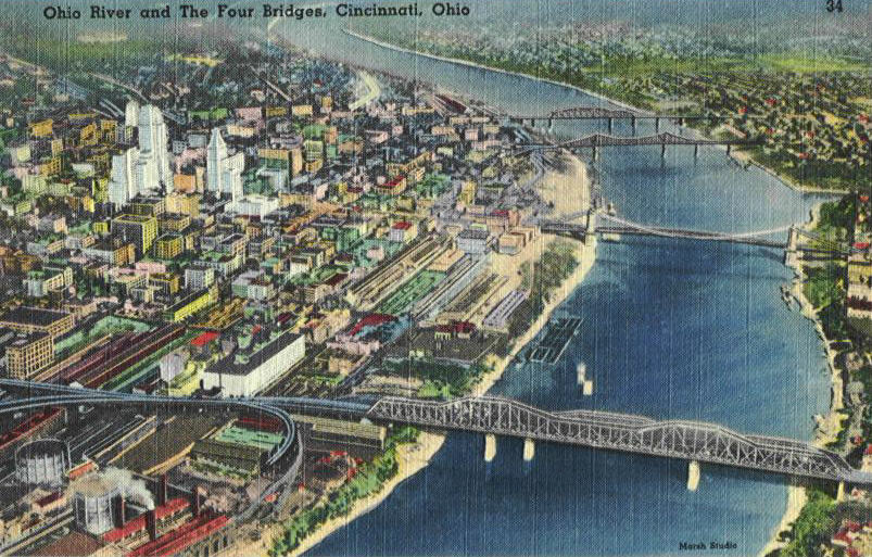
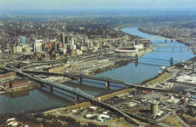
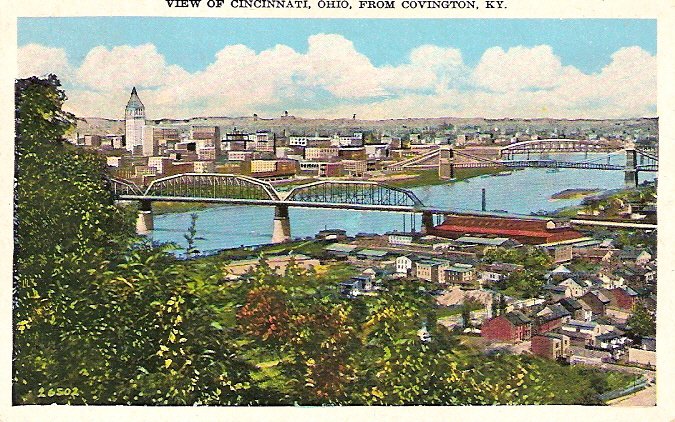
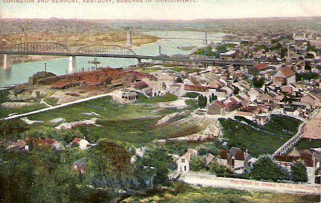
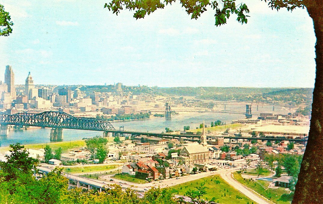
We will start our little tour of the
bridges that front Cincinnati proper by looking at the bridge furthest east and
work our way up river. The first three cards show the Ohio River with the
city seen in the distance. The bridge you see in these cards is the
Cincinnati Southern Railroad bridge. The next five cards show this bridge close
up. The Cincinnati Southern remains the only railroad owned
by a city in the country. It was started in 1869 by Cincinnati business and
political leaders to establish a profitable economic relationship with the
states to the south of Ohio. The 350 mile line terminating in Chattanooga,
Tennessee, was completed in 1880. This railroad is municipally owned and was leased
to the Cincinnati, New Orleans & Texas Pacific line.
The bridge, constructed in 1877, was the third bridge
to span the Ohio at Cincinnati. Although principally a freight operation it also
carried paying passengers. The depot was in Ludlow, KY. To see the depot cards
you will have to go to the Northern Kentucky site mentioned on the Main page. Go
to Kenton County and then Ludlow. You will also find many train views there. A
footbridge was added to the original bridge and, in 1921-22 it was completely
rebuilt.


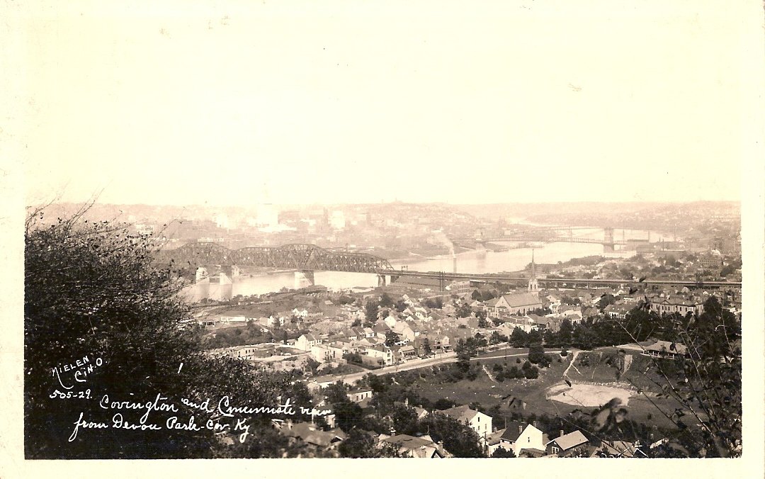
The last aerial photograph above shows the bridge as it looks today.
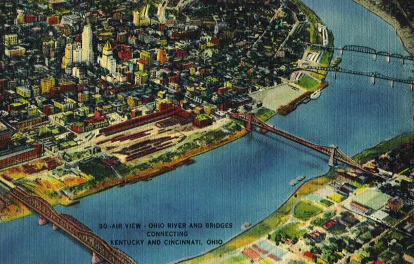
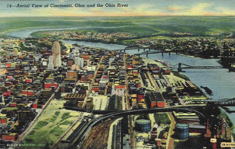
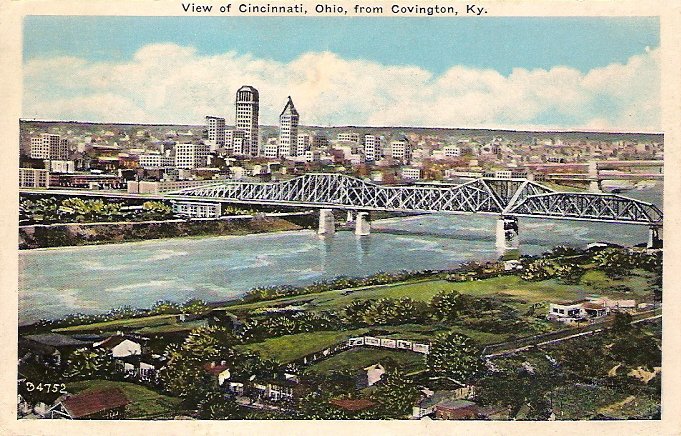
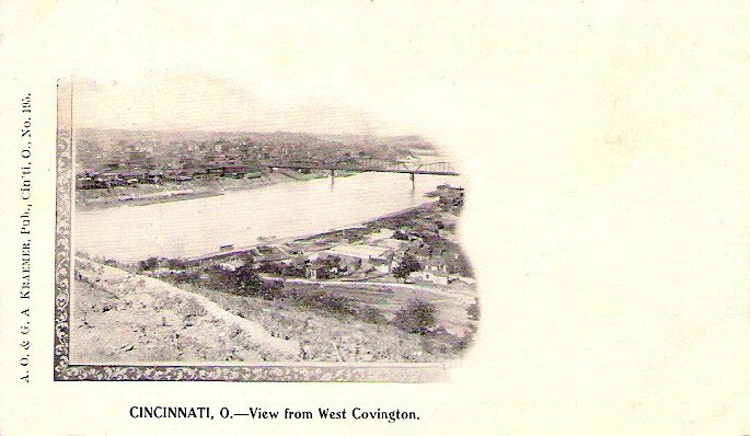
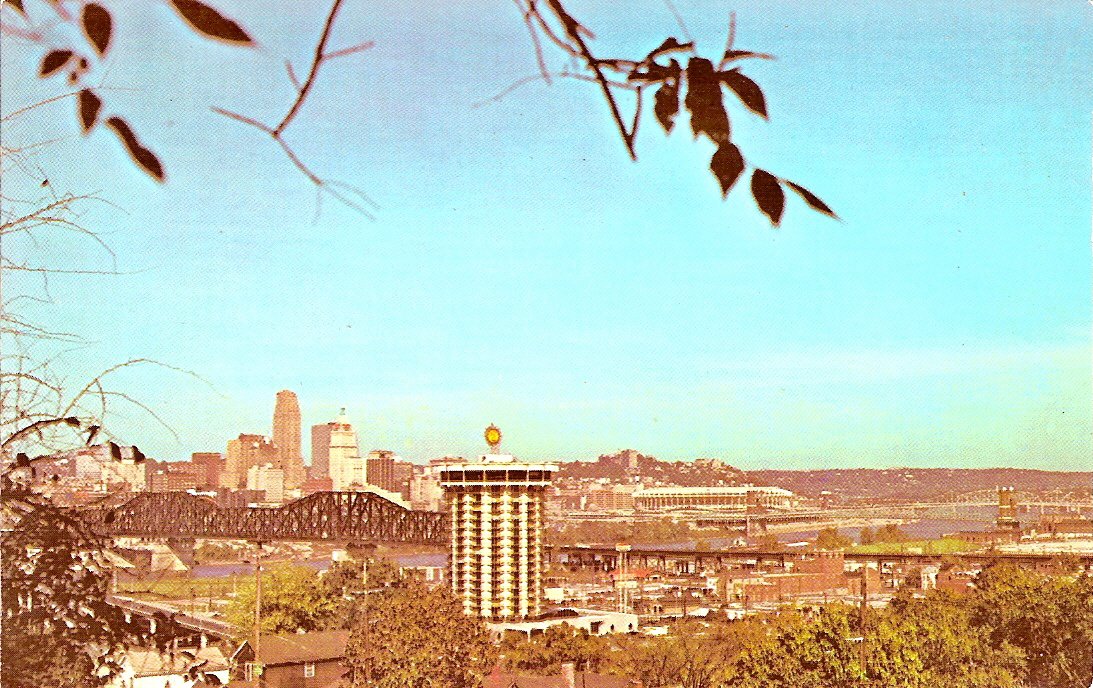
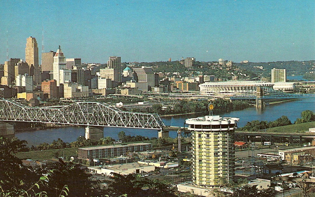
The first row of cards below are aerial views of the other bridges we will be looking at. The Brent Spence Bridge is not shown in these cards, nor is the I471 (Big Mac) bridge since these cards predates both of those bridges.


BRENT SPENCE BRIDGE
The next bridge in our little trip is the one not seen in
the second row of cards. It is called the Brent Spence Bridge and is the main connector of the I-75
interstate highway running from Michigan to Florida across the Ohio,
opened in 1963 it is a double decked bridge for
vehicles only.

Construction of Expressways
Photograph
Brent Spence was born in 1874 in Newport, KY. he served as a state
senator from 1904 to 1908 and was a member of the United States House of
Representatives from 1931 to 1963.
The day this bridge opened on November 25, 1963 was a very sad
day in the history of the United States. President John F. Kennedy was buried
that day. As a consequence there was very little ceremony to the opening of the
bridge. In conjunction with the bridges opening all tolls on the John Roebling
Suspension Bridge ceased. Due to the traffic jams caused by local traffic the original
three lanes in each direction were narrowed to four lanes. Originally designed
to carry 80,000 vehicles a day was exceeded by 1968 and the average traffic count
is now over 156,000 per day and because of the four lanes there are now no
emergency lanes that can be used. A new bridge is now in the works to begin? Cost of the original bridge was around $10,000,000 and the estimated cost
of the new bridge is from $3.03 billion to?
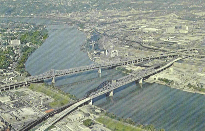
(C & O is other bridge shown above)


Approach from Cincinnati
side.
THE CHESAPEAKE & OHIO BRIDGE
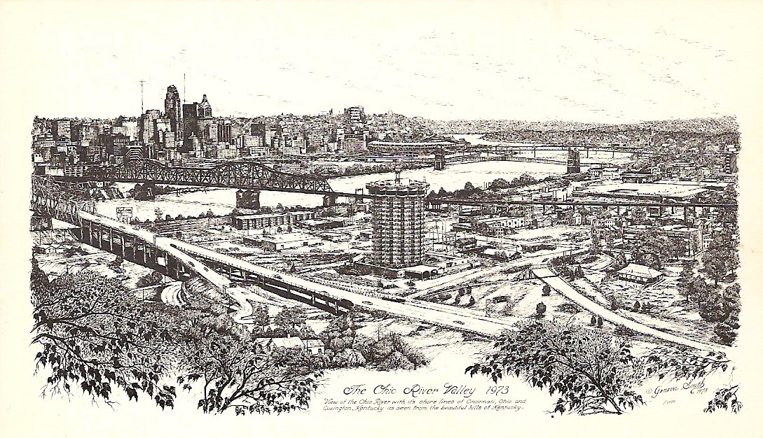
The next bridge seen to the right of the Brent Spence Bridge and the first bridge seen in the first five aerial views above was called the Chesapeake & Ohio Bridge. Completed in 1888 the opening was delayed until 1889 due to a damaging flood. It was the fourth bridge built, and was the city's first double track bridge. It also boasted the longest center span of any other railroad bridge in the world. The non-postcard image below shows this bridge under construction in 1888.

In 1928-1929 a
new C. & O. double track bridge was built next to the original structure,
even sharing some of the stone bridge piers. After the new bridge opened to
train traffic, the original bridge was purchased by the commonwealth of Kentucky
and converted into an automobile bridge. In 1970 the
old bridge was blown up and in 1974 a new bridge was built on top of the
original piers.
This bridge is called the Clay Wade Bailey bridge.
Named after a Kentucky newspaperman who covered the Kentucky capitol in
Frankfort for many years and was a favorite of the legislators who wanted to
honor him in this way.


THE SUSPENSION BRIDGE IS NEXT BUT DUE TO THE LARGE # OF CARDS IT HAS ITS OWN PAGE. CLICK LINK ON TOP.
CENTRAL BRIDGE
The next bridge in line after the Suspension Bridge was the Central Bridge. This was the fifth bridge to be built and was opened in 1891. This was not a railroad bridge but was strictly for people. It was a toll bridge until 1953 and was called the Central Bridge because it was between the Suspension Bridge and our next bridge the L.& N. Bridge. This was the first cantilever truss bridge ever constructed. This design became common worldwide. From 1992 to 1995 it was demolished and a new bridge, the Taylor-Southgate Bridge, was built. The name is derived from two famous families responsible for much of the formation of the area in Northern Kentucky. James Taylor Jr. was responsible for the formation of Newport, KY and Campbell County, and Richard Southgate who became a State Senator and Representative. The city next to Newport, Southgate, was named after him. The 1st image is not a postcard.


Drawing by Farny
Corner 2nd-Front-and
Lawrence Sts. Bridge behind


Despite what the card says, this is actually the Central Bridge.
Not a postcard

View from Central Bridge
LOUISVILLE & NASHVILLE BRIDGE
The second bridge to be erected at Cincinnati and the fourth bridge to span the Ohio River was the L.&N. Bridge which was completed in 1872. It was originally called the Newport and Cincinnati Bridge, it was renamed the L&N when the Louisville and Nashville Railroad bought the bridge in 1904. A single track rail line was flanked on both sides by a roadway. It was also a toll bridge, (you can see the booths in the 7th card). The bridge was torn down in 1895-1897 because it was not wide enough to handle transports and the wider wagons being used. The new bridge was built on the old piers and abutments. A streetcar line was added, (nicely seen in the 5th card). In 1987, rail use stopped and it was used for automobiles only. It was closed in 2001 and made into a bridge strictly for pedestrians and bicycles. It is now called the Purple People Bridge.