![]()
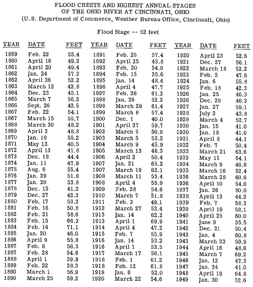
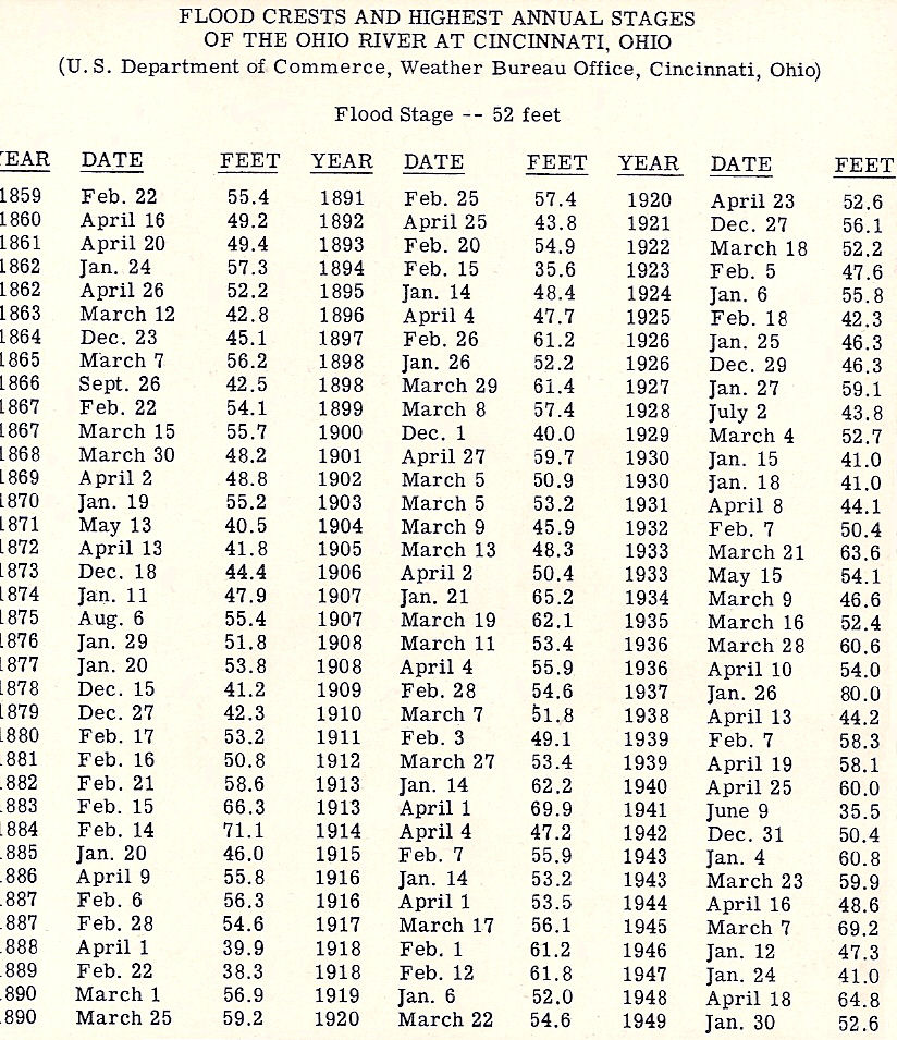
Flooding of the Ohio River is very common and the problem is easy to explain. The Ohio is 981 miles long measured from Pittsburgh to Cairo at the junction with the Mississippi River. The Ohio and its tributaries are found in all, or parts of, 14 states draining an area of 204,000 square miles. With that much area to drain it is not hard to see why from 1858, when official records were first kept, to 1937 the Ohio had passed or equaled flood stage ,of 52 feet, 54 times. Ninety-five percent of all floods have occurred during the January-April period with March accounting for nearly one-third. Only once has a flood happened in summer and that was in August of 1875 when the river rose to just over 55 feet. From 1858 to 1937 the Ohio had gone over 60 feet 13 times, over 65 feet 5 times, 69 feet 3 times, and 70 feet twice in 1884 and of course 1937. In 1907 there was a rarity, there were two floods. One on January 21 at 65.2' and then another on March 19 at 62.1'. The chart below shows the high water mark for every year up to 1949.
Ice has frozen over the entire width of the Ohio many times but the one that occurred in the winter of 1917-1918 was much more devastating to shipping than had ever happened before. The fact that the ice was 2 feet thick and that the Ohio was flooded (it crested on February 2nd at 61.2 feet) were the main reasons for the destruction. On January 30, 1918, a loud report was heard at 10 a.m. as a great crack shot across the river from the Public Landing. A minute later the ice began to move with demonic fury. Steamers, towboats, wharf boats, and ferries were pulverized. Boats that had already sunk from the ice shot up into the air as submerged ice hit them a second time. I do not have a listing of the tonnage lost but it was considerable.
I really do not have any enlightening comments on these cards. The destruction of all tornados look remarkably identical. I will let the cards speak for themselves.
BRIDGE COLLAPSE
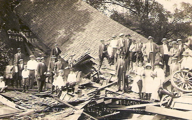
Hatka's covered wooden bridge, in Reading Ohio, collapsed on August 10, 1912. It spanned Clark Road connecting south Reading to Arlington Heights. The cause was blamed on overloading. A Norwood contractor (James McJoynt) was hauling cinders in three wagons when the bridge collapsed into the Mill Creek 25' below. The three African American men driving the wagons were injured while the horses, amazingly, were unhurt.
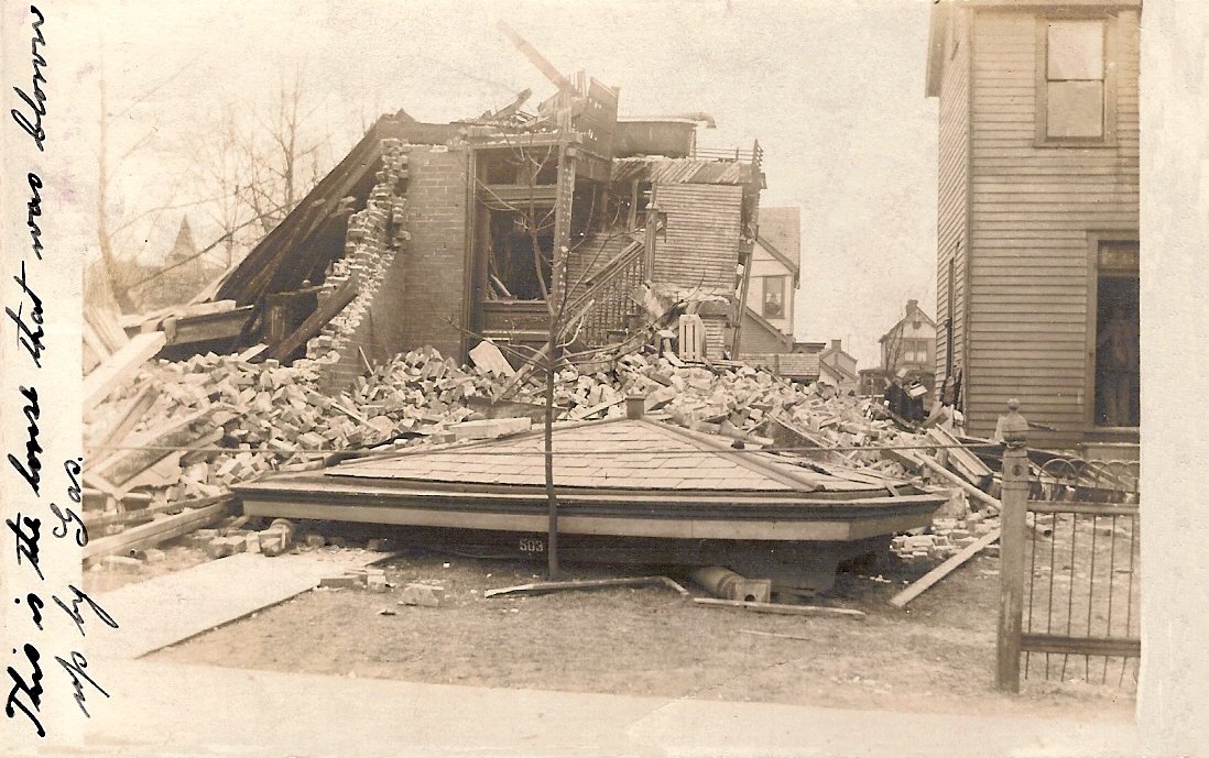
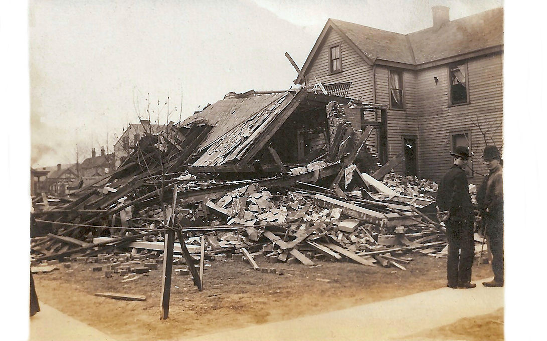
GAS EXPLOSION
These two cards show a house destroyed by a gas explosion in February 1907 at the corner of Locust St. and Highland Avenue in Elmwood Place.
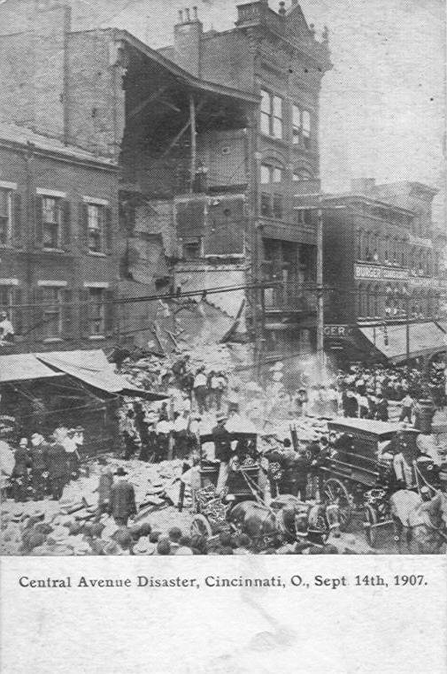
BUILDING COLLAPSE
On September 14, 1907 the facade and 35 feet of walls of this building at 625-627 Central Avenue collapsed. Three people died, two residents and a passing pedestrian. The ground floor was the Dohan's Shoe store and was being renovated. During the renovation the foundation walls buckled which dislodged the main weight bearing girder.
RED CROSS
The Red Cross can be found at any disaster so it is only appropriate that it is found here.
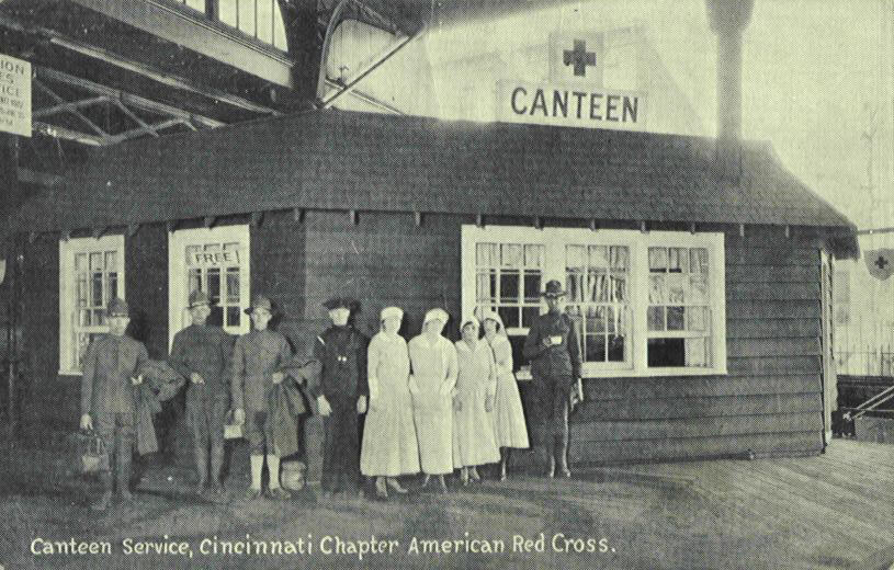
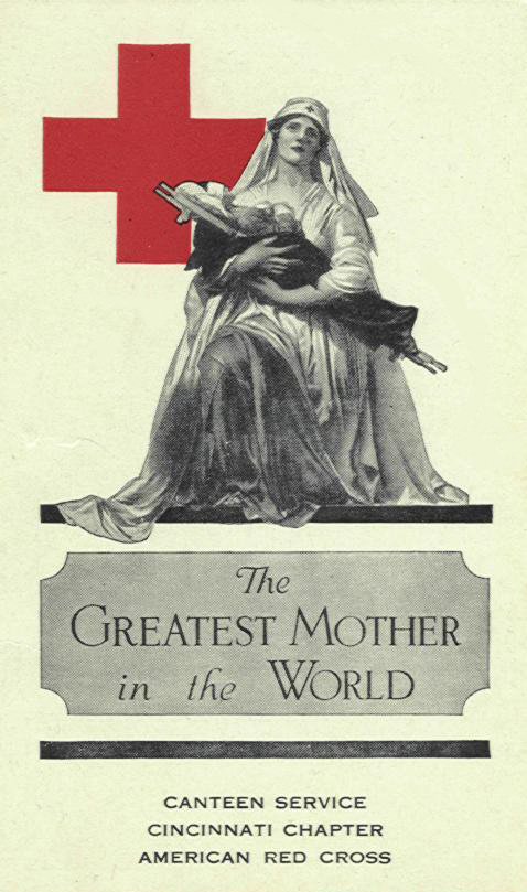
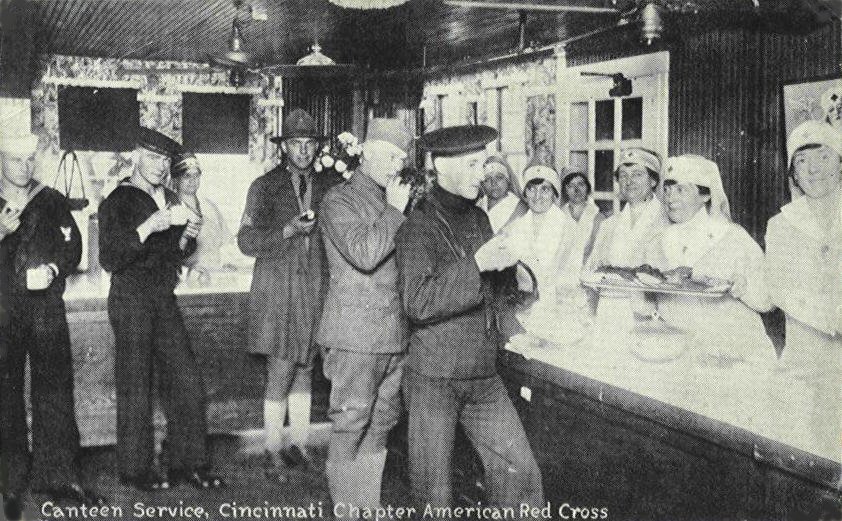
During the flood in 1884 Clara Barton, the organizer of the American Red Cross, came to the city to direct relief efforts. 21 years later Mayor Julius Fleischmann held an organizational meeting on May 10, 1905 to get Cincinnati's own Red Cross unit started. The first Red Cross office opened in 1912 in a home at 222 W. Fifth Street. They had a budget of $10 a month for two rooms, 90 cents for desk supplies and 30 cents for latch keys. I have not been able to find out where the canteen shown in the cards above was located. (it looks like it was under a bridge or viaduct).
