![]()
![]()
![]()
![]()
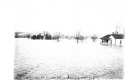
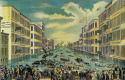
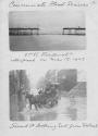
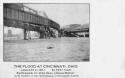
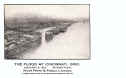
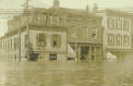
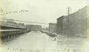
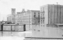
1883 FLOOD
The 1883 Flood crested at 66.3 feet on 2/15/83. The image above had to be scanned in two parts due to its size.
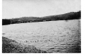
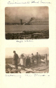
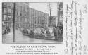
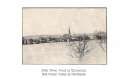
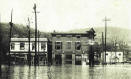
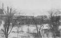
1884 FLOOD
The lithograph of the 1884 flood above shows the Suspension Bridge in the distance, so this would have to be Walnut Street we are looking at.
3rd & Mill
St.
Front & Vine
Sts.
River
Front
Public
Landing
East Pearl St.
Location
unknown Suspension
Bridge Grand Central
Depot Location not
known
Gas Works
Gas
Works
Lower Market
Location
unknown
Newport
Newport
Location
Unknown
Location
Unknown
Aurora, Indiana
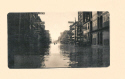
1888 FLOOD
Two newspaper illustrations of the flood
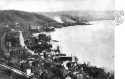
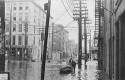
1890 FLOOD
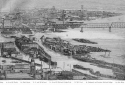
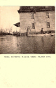
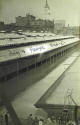
The 1890 flood was not a very bad one, it only crested 7' over flood stage of 52'. The photo above was probably taken from the suspension bridge showing the tow boat Hercules Carrel moored in front of the Globe Soap factory which was located on Water Street. This street was obviously named because it would flood every time flood stage was breeched.
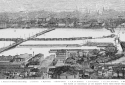
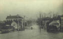
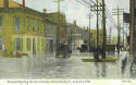
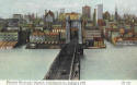
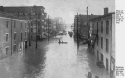
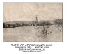
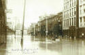
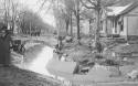
These are postcards of the 1907 and 1913 floods. There are not as many postcards of the 1937 flood compared to the earlier ones for obvious reasons. The postcard craze had faded considerably by 1937. People were able to see all the pictures they wanted by buying a newspaper, or going to theaters to see the newsreels, and of course radio. People no longer needed to collect postcards in order to remember historical events. The first non-postcard image is a map that was drawn in 1888 that will give you an idea of where the streets back then were located during the early Cincinnati floods. Of course many of these streets no longer exist, later construction has demolished many of the riverfront streets plus many of the other streets have had their names changed.
![]()
Map-Riverfront to 8th St.
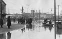
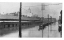
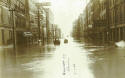
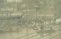
1907 FLOOD REAL PHOTOS


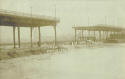
From L & N
bridge
Along the
canal
8th street
viaduct Walnut
St. Looking South
8th St. Viaduct
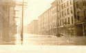
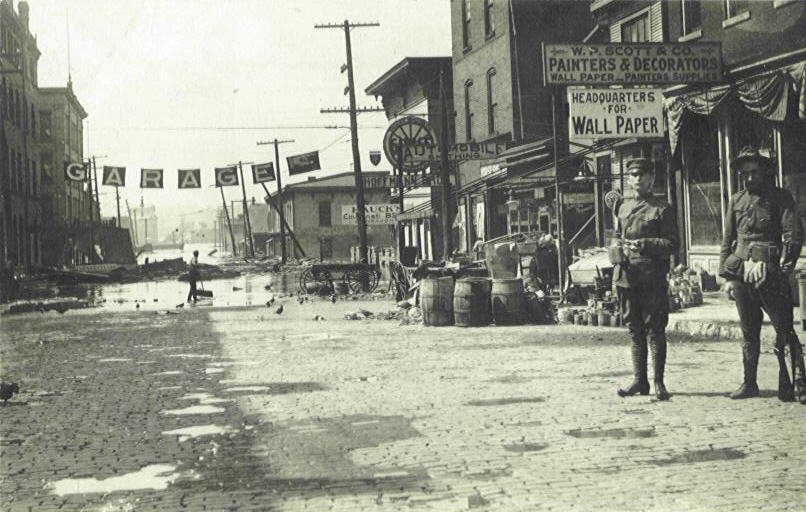
The first card above show the flood waters half-way up to the roof of the L. & N. (Panhandle) Railroad Depot. The 8th Street Viaduct collapsed on March 17, 1907. The 120' section fell into 28' of water along with gas and water mains, telephone and telegraph lines, electric power lines, and trolley lines that were all connected to the structure or were under it, on the ground. The collapse created an 18' wave that went into the surrounding streets for two blocks. The piers had been undermined by the earlier flood that year due to the very porous soil that was used as filling material.
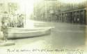
2nd and Market sts.
Shaw Ave. Hyde
Park Walnut St.
looking
South
Cincinnati Suburb
Looking south on Walnut
Location Unknown
2nd St. Looking East ?
from Pearl Street.
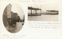
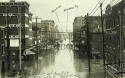
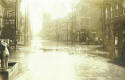
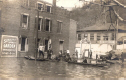
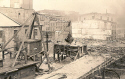
The postcard above was possibly taken from the Suspension Bridge. It shows the C. L. Greeno Co. that was located at 325 Main St. (far right, they were in the upholstery goods business. On the left edge is the J. R. Ware & Co. located at 19 E. Water St. They were in the sand business as can be seen by the crane positioned over a sand hopper.
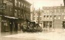
Viaduct & 2nd St.
Suspension & Crowd
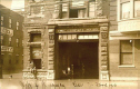
Thomas P. Zachman was a feather renovator and his business, seen near the center of this image, was located at 4024 Hamilton Ave.
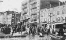
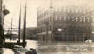
1907 FLOOD PRINTED CARDS
Spring Grove
Ave. Top
of Suspension Bridge
Central Union
Depot
Suspension Bridge Ferry
The first card above shows the flooding of Spring Grove Avenue caused by the Mill Creek overflowing its banks by as much as 4 miles in places.
East
End
Front Street
River front & Public Landing
Northside
"Flod" in Cumminsville
Although the two cards above are titled differently they are both in the same general area.
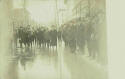
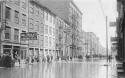
1907 FLOOD PHOTOGRAPHS
East
End
Vine St. From
2nd
Shantytown
Public Landing
E. 2nd St. From
Suspension
Eastern
Avenue
Central Ave. From
Pearl Trader
Ave. East End
Pearl & Plum
Sts.
Pearl & Walnut
Sts.
West 3rd
Street
River Front
West 2nd
Street
Lower Plum
Street
Lower Plum
Street
West 2nd Street
MIAMI (MIAMITOWN)
Miami Mill
Miami changed its name in the 1920s to Miamitown.
1913 FLOOD REAL PHOTOS

Knowltons
Corner
Vulcan Supply at 120
Sycamore 3408
Liston Ave
South on Main from 3rd
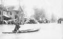
4th and
Broadway
Island
Queen
Location Unknown
Esterman Verkamp Murphy Co.
Wholesale Grocers Front & Main
Pearl and
Broadway
116 east Pearl
St.
Pearl St. W. of Main Pearl St. between 2nd &
3rd Pearl and
Broadway
(Princess in distance}

 *
*
Pearl St. at Plum St. Cor. Of Pearl & Broadway Sts.
Pearl
& Elm
Pearl & Eggleston
Queen City Supply Co.

1373 Harrison
Ave.
Location
Unknown
Location Unknown


Western Avenue
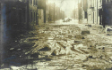
Casualty of the
flood
Cleaning up the
mess

Freeman & Hopkins
Sts.
Walnut & Front
Sts.
Front St. from
Race
Walnut
Street Looking South
Big 4 Depot
Freeman Avenue
Sherman Avenue
Colerain Ave. & B&O tracks
Location Unknown
Schulte's Park -Liston Ave.
& Anderson's Ferry Rd
 *
*
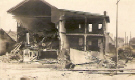
The American Oak Leather Co.
Fire Company
#20 Location Unknown
Cleves-after the flood
and the Hall Lumber Co
Kenner and Dalton Ave.

I can not verify that this is Cincinnati.
I do not know what street this is.
There is a Haucks beer sign in background.
It is still a nice card.
Norwood
The William Glenny Glass Co. 10-16 Commerce
Location unknown

Harrison Ave. Viaduct
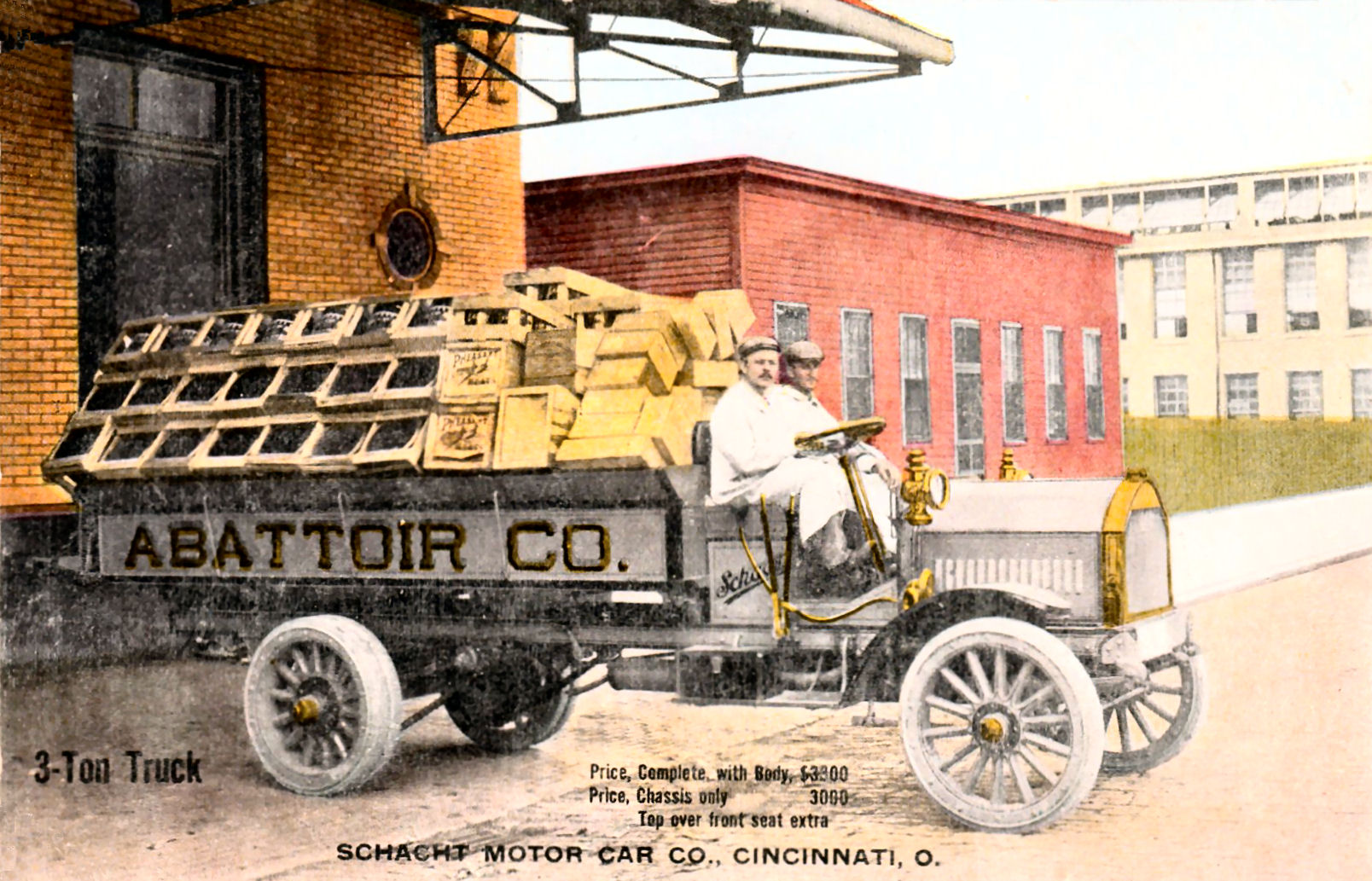
Abattoir Co.
Cincinnati far right
The Abattoir Co. was located on Spring Grove Ave. They were Pork & Beef Packers. The view was taken from their roof looking towards Camp Washington. The last card can also be found in the Transportation section with more of an explanation.
HARRISON
Site of suspension bridge
collapse
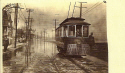
Sedamsville streetcar
The RPPC (reprint) image above was taken somewhere along River Road. I do not know which flood this is.
FOR MORE
1913 FLOOD CARDS ![]()