I-275 CIRCLE FREEWAY TRIVIA
Any Cincinnatian probably has wondered at some time in their lives just how long I-275 is. Well you now can amaze your friends with your superior knowledge. It seems everybody who should know this have their own figure. It varies from 82.98 miles to 84.8 miles. An actual odometer reading by an Enquirer reporter read 84.5 miles. In any case I-275 is the longest full circumferential beltway in the nation. It passes thru 3 states; Indiana, Kentucky, and Ohio. In case you were wondering what the next longest beltway is, it is the I-495 Capital Beltway, Washington D.C., at a mere 67 miles. Atlanta is third with I-285 at 62.8 miles.
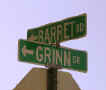
Corner in West Chester
Mount Adams
Anyone else have a picture of a funny or strange Cincinnati area street corner?
ADDYSTON
AVONDALE BLUE ASH
*
Main Avenue
847 Glenwood Ave.
Cooper Ave.
The Glenwood Ave. residence is no longer there.
BRIGHTON
The 2nd image above is a photograph of the corner as it looks today.
BOND HILL
Paddock Rd. S. from Myrtle
Forrest Ave. E. from Paddock
CLEVES
Miami Looking South
Miami South
on Porter
North on Miami Between Laird & Markland Sts.
The last image above is a present day photograph, thanks to Kevin Lawson.
The last image above is the RPPC image that was used to make the 3rd card. Thanks to Scott Kabakoff. The building on the left side was the general store of Frank Ingram. It was used by the Cincinnati Public Library as station #33 in its free delivery system. A person could order, and pick up, a book from the main library downtown. The third image is, what I believe, this area looks like today. It is the corner of Miami and Mulbury Streets.
The 2nd present day image is nothing but a guess on my part. It is the closest I could come to a possible match.
CARTHAGE
The 2nd present day photograph above shows that the church in the 1st card still stands. Today it is the Annoited Church of Christ at 7013 Fairpark Ave. on the corner of West Seymour Ave.
CLIFTON
The fountain shown in the third card above was donated to the people of Clifton by Henry Probasco, the person who donated the Tyler Davidson Fountain in honor of his business partner. This fountain was dedicated in 1887 and is located on Clifton Avenue near McAlpin Avenue. 10 feet tall the top basin had an attached dipper for drinking. The lower basin was for watering horses, and at ground level there are side bowls that provide water for thirsty dogs. The last image shows what the fountain looks like today.
CHEVIOT
*
Harrison & North
Bend
Harrison & Cheviot Avenues
The 2nd and 4th non-postcard images above shows what the areas in the postcards to the left look like today.
DELHI (SAYLER PARK)
The 1st two cards are looking down Lincoln Ave. from Main Street. Lincoln Ave. is now Gracely Drive. Sayler Park has been known as Delhi, Lower Delhi, Home City, and Fernbank. The 3rd non-postcard image shows this corner as it looks today. Thanks to Ed Cipriani I am able to identify the last Delhi card. The building was the Delhi Post Office. Owned by his mother, and was located at the same corner of Gracely Drive (Lincoln Ave.) and Revere Ave. The building was used, over the years, as a telephone exchange, Post Office, Kroger and then a Strassells Grocery.
ELMWOOD PLACE
*
Walnut
& Highland
Corner of Walnut and Vine Streets
The 2nd & 4th non-post card images above shows what the areas looks like today. Thanks to Kevin Lawson for the last image.
1st National Bank on left
Highland Ave.
FAIRMOUNT
GLENDALE
The Willis & Dooley
Block. 20-29 Village
Square.
Tornado damage 8/19/12 Block As It
Looks Today
The Willis-Dooley Block was built in 1880 to replace a wooden business block that had been destroyed by fire. This building consists of two parts, the three story section contained the Masonic Hall on the top floor that was used by the Glendale Masonic Lodge until 1887 when the meeting place was moved to the nearby town of Wyoming. The remaining parts of the building have always been an important landmark containing many Glendale businesses over the years. Mr. Willis was the original proprietor of the coal yard, and Mr. Dooley was a carpenter and builder of many of the homes in Glendale. The last two images are not postcards.
Fountain Ave. Looking
West
Fountain Ave.
HARRISON
Main Street (Harrison
& Walnut)
Market
Street
Main street is now Harrison. Thanks to Kevin Lawson for the 3rd & 5th photographic images. The 2nd postcard may be mis-identified.
*
State St. & Harrison
State Street & Broadway
The 2nd photographic image is a present day view of the 1st card. The 4th image above is a present day photograph of the house on the left in the 3rd postcard. Thanks to Kevin Lawson.
Thanks to Kevin Lawson for the 4th photographic image.
Harrison Avenue. State Line runs down the center of the street. Indiana on one side Ohio on the other.
Koole Korner-Harrison Ave.
Real Photo
Postcard
Sycamore Street
HARTWELL
Although the RPPC above says Hartwell, there is a problem. There may have been a Sturgis Ave. when this card was made (1914) and had its name changed, but there is no street with that name in Hartwell today. There is a Sturgis Ave. that is located 4 or 5 miles south of Hartwell in North Avondale and it is this location I believe this image was taken. I believe the street where the boy is sitting is Dickson Ave.
FOR MORE SUBURBAN
STREETS ![]()

