DOWNTOWN STREETS
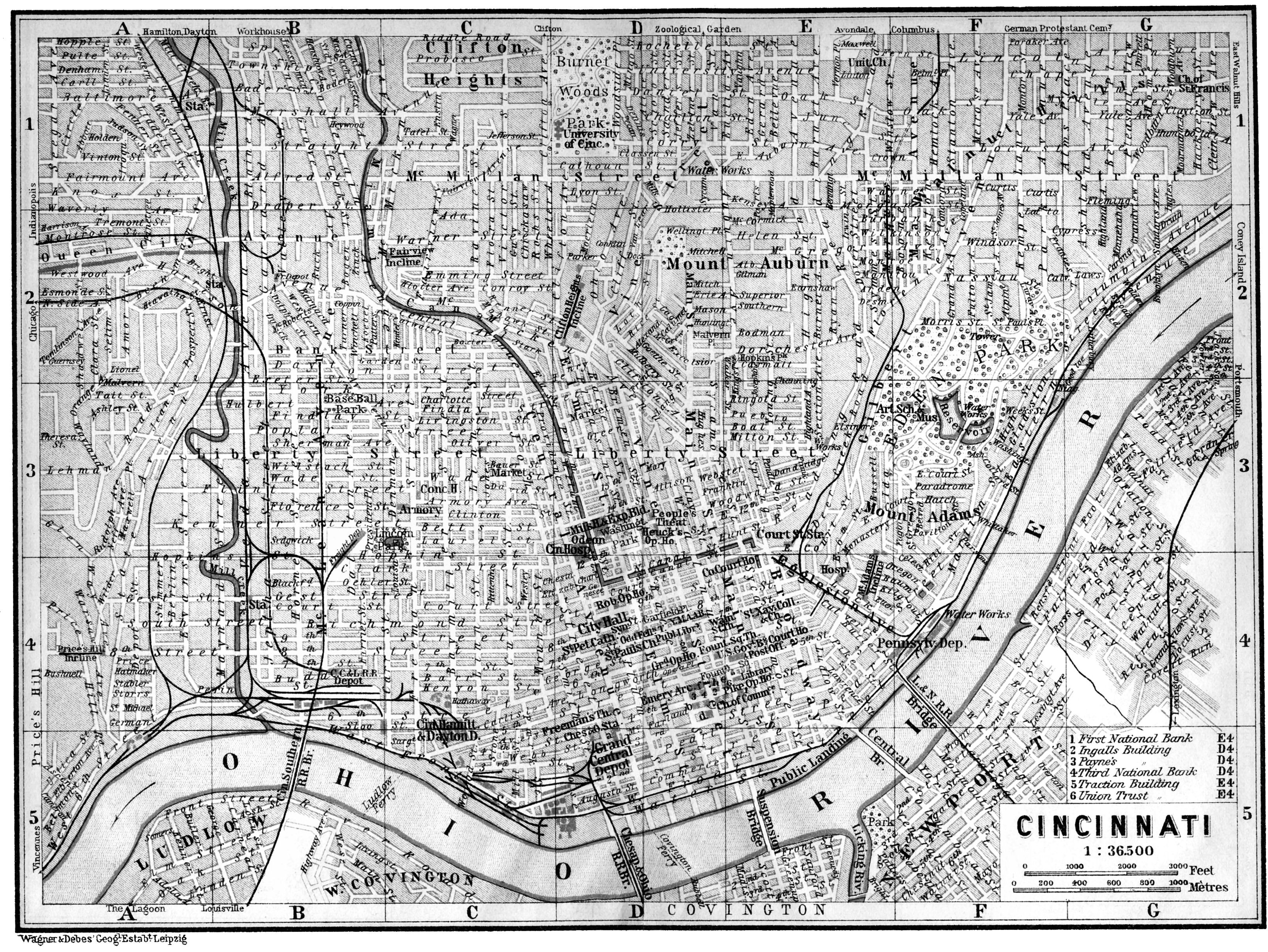
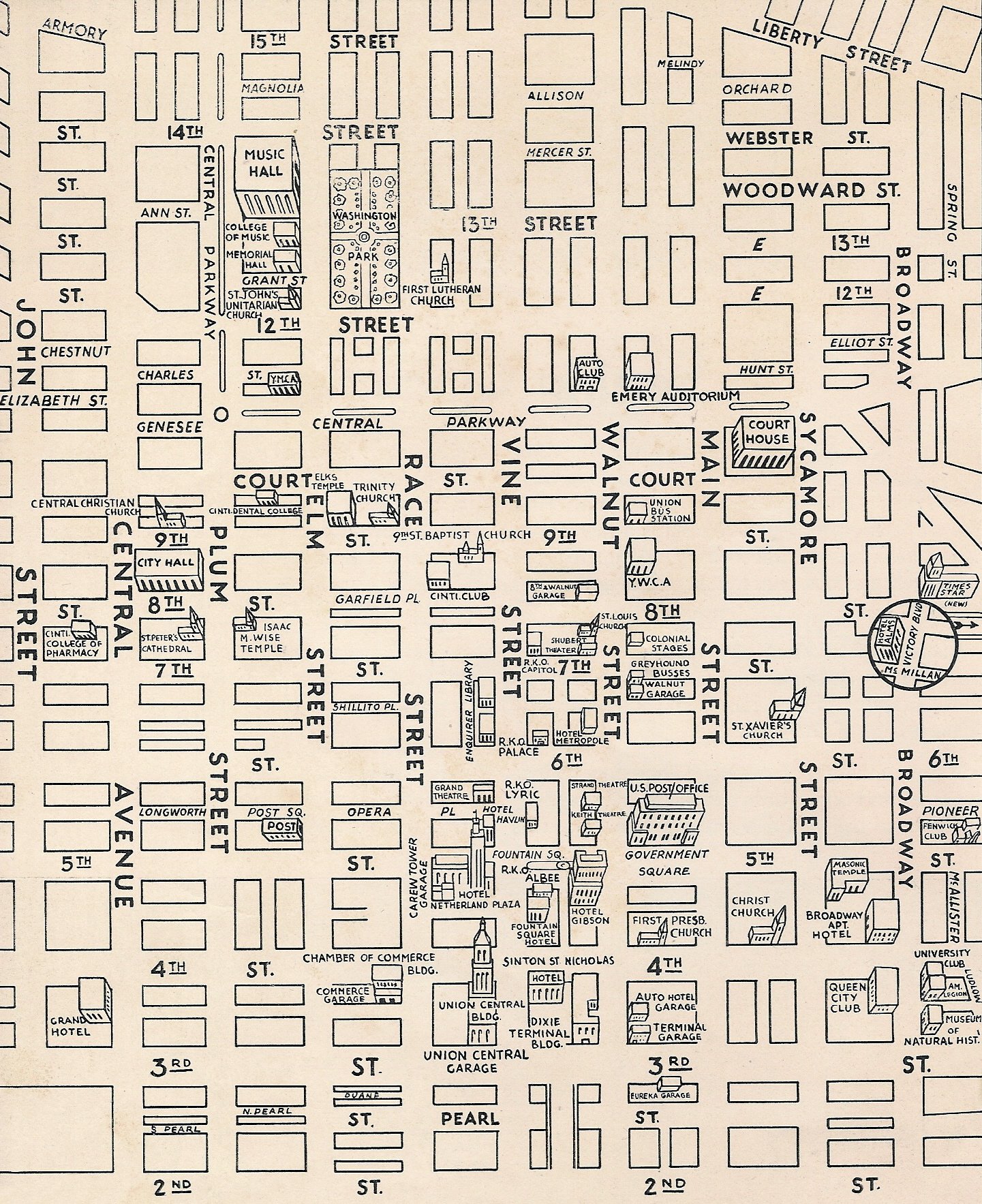
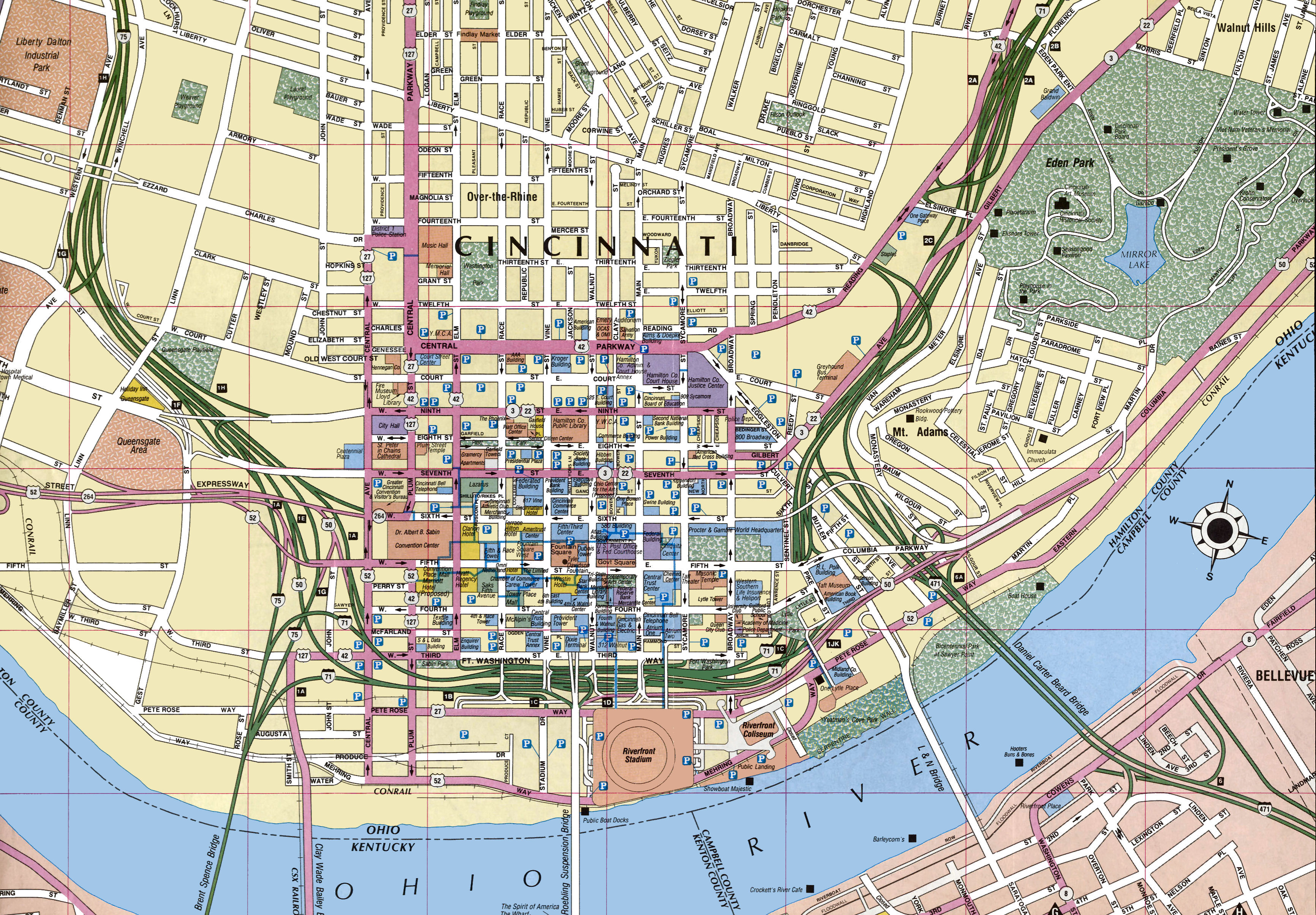
Here are 4 maps of downtown Cincinnati from 4 different eras, The 1st one shows a much wider area and is from 1903, the 2nd one is from the 1930s, the 3rd one is from 1942 and the 4th one is from around 1993 (you can tell because the Central Bridge is missing). These were chosen because they all show where many of the buildings are, and were located although the 1st one is not that helpful.
A bit of trivia. Street Numbers are:
Even
on East & North sides
Odd on West & South sides
You must keep the following in the back of your mind as you go thru the many images on this web site. The present numbering system for buildings was adopted in 1897. Before that the addresses ran consecutively from the Ohio River. Today 500 Walnut, for instance, is at Fifth and Walnut Streets. Before 1897, 500 Walnut was around 14th Street. Before 1897 Main Street was the dividing line between east and west streets, after 1897 Vine Street became the dividing line. See 1891 Ordinance #152 below. It seems that over the years the number of streets that have had their names changed number in the many hundreds if not thousands. If you would like to see what SOME of the street name changes have been, go to the Facts Page.
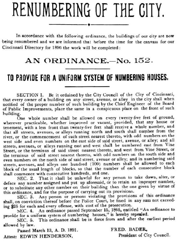
1891 Renumbering Ordinance
THE GEST STANDARD- From 1819 to 1844, Joseph Gest was the city of
Cincinnati's engineer responsible for surveying the area between the Ohio River
and McMicken St., and from Eggleston Ave. to Freeman Ave. Distances were measured
using a 66' long instrument called a surveyor's chain. Gest was unaware that a
24" English brass rule he had imported to make his own chain had been
extended by 1/32" by the makers to reduce wear on the ruler's end. Unaware
of the change, Gest used the full length as his standard. As a result the City
of Cincinnati's downtown is about 5 acres smaller than the early plats show.
Today's engineers must use an adjustment known as the "Gest Standard"
to the early plats of Cincinnati to make them conform to the actual distances.
There is a street that you will not find on the third map above but
you will find on the first two. This street was between 5th Street and 6th
Street, starting west from Vine Street. This was a very unusual street in that
it had four different names and its length was only 10 blocks. Starting at Vine
St. it was known as Opera Place until it reached Elm St. The next block to Plum
St. it was called Post Square, and from Plum St. to Central Ave. it was known as
Longworth St. Finally from Central to Baymiller St. it was known as Carlisle
Ave!
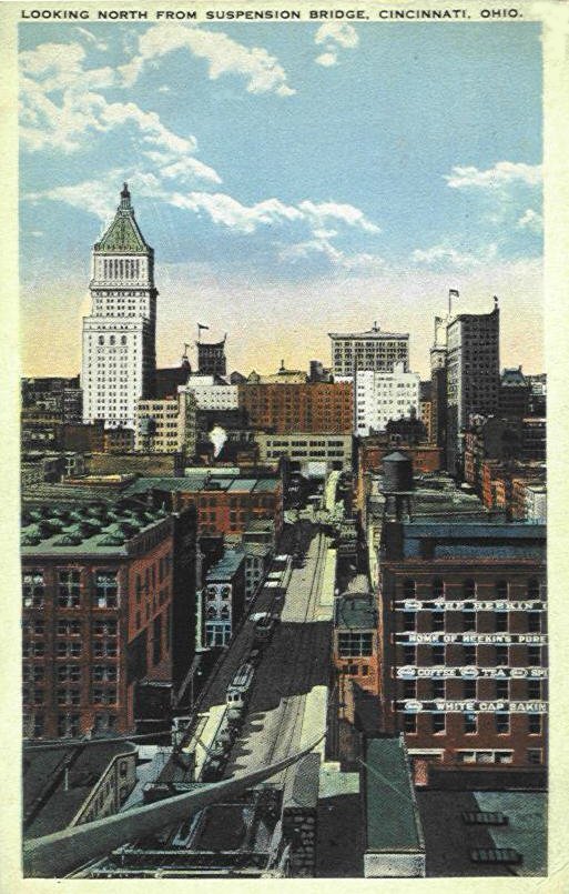
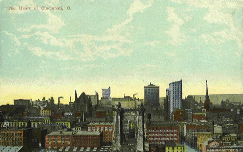
TOP OF SUSPENSION BRIDGE
FRONT STREET
PEARL STREET
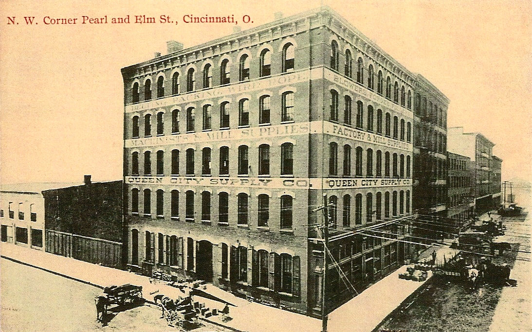
Reprint
N. W. Cor. Pearl & Elm Sts.
THIRD STREET
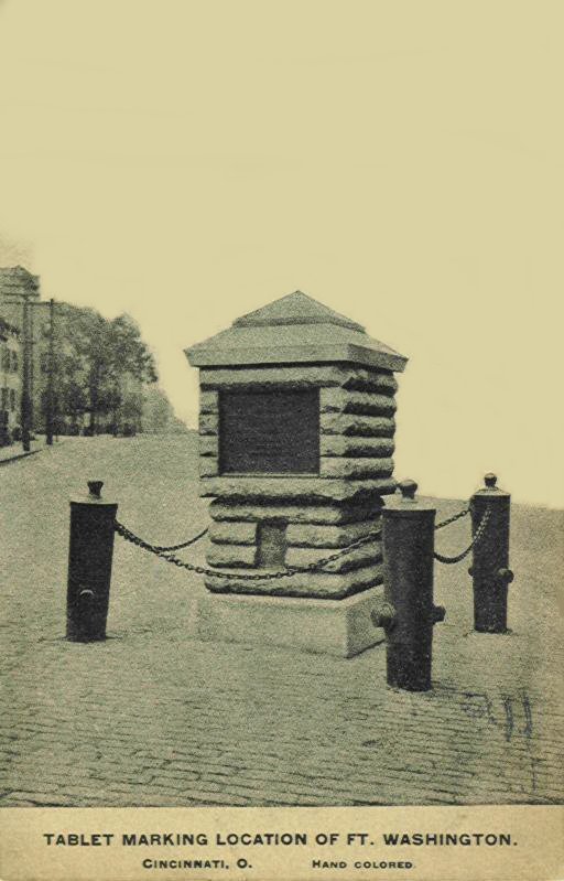
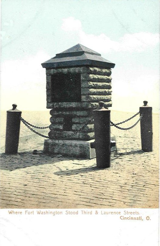
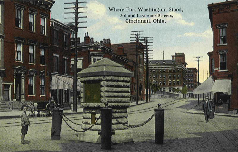
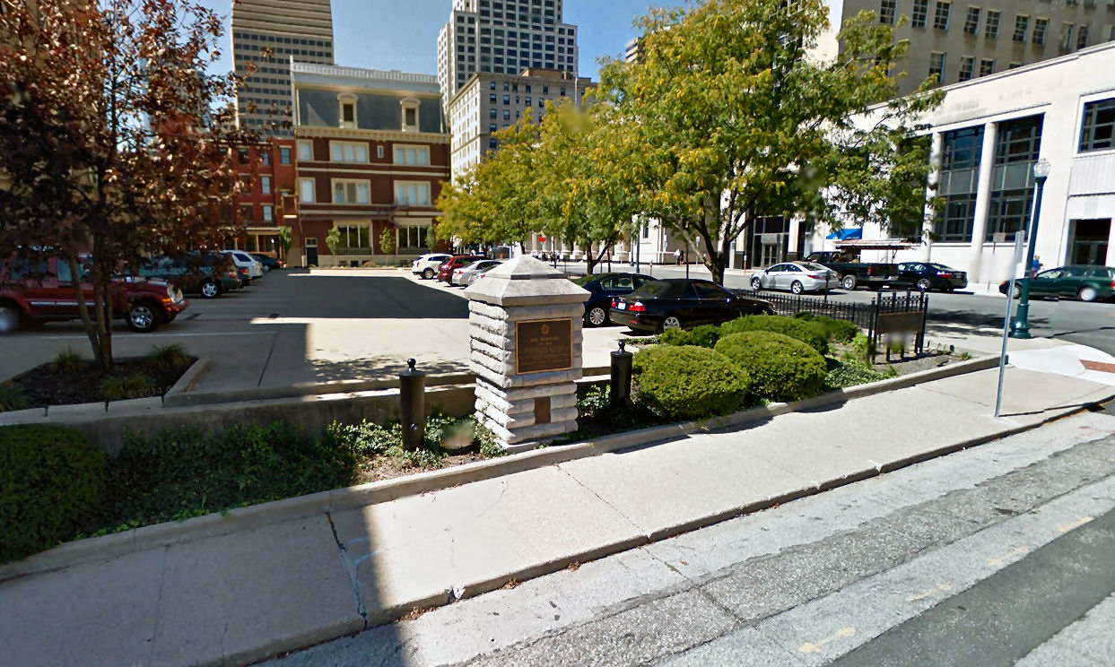
Fort Washington Monument Located at 4th &
Ludlow St. (Now Arch St.)
The last image above is a present day photograph.
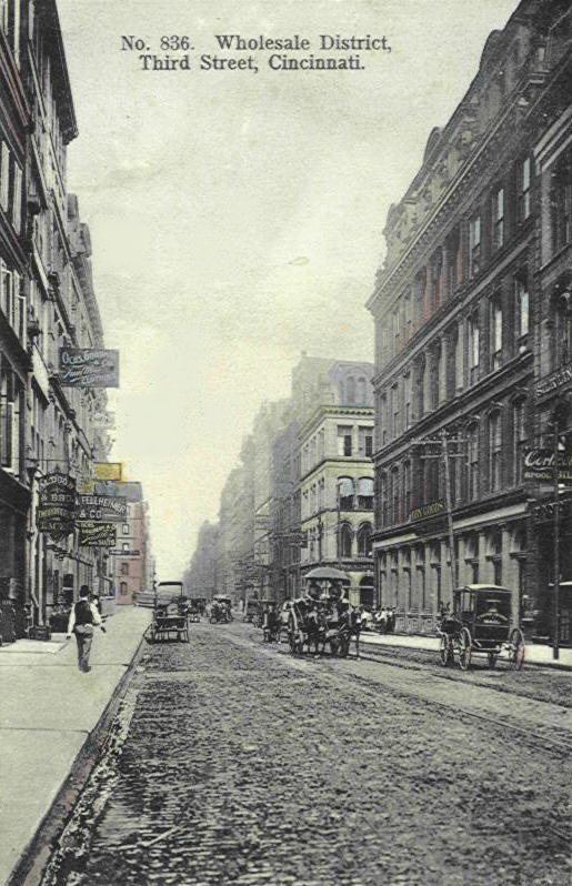
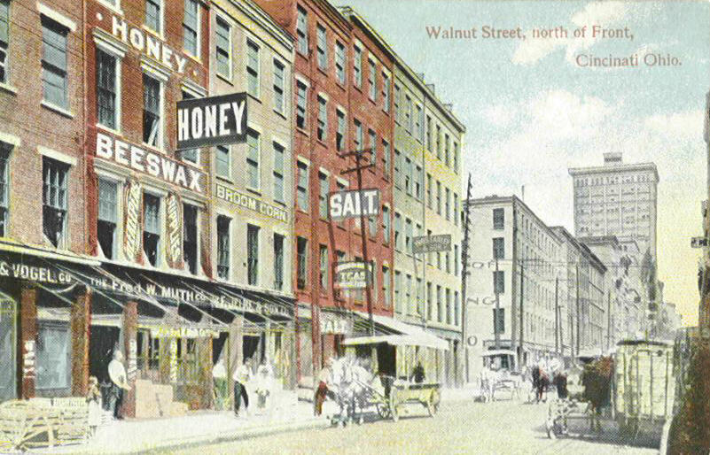
Wholesale district
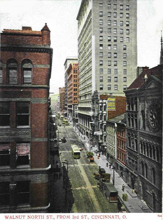
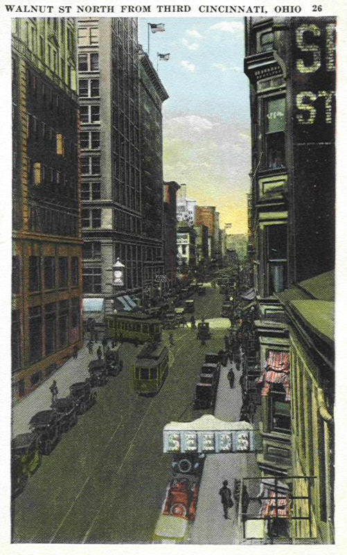
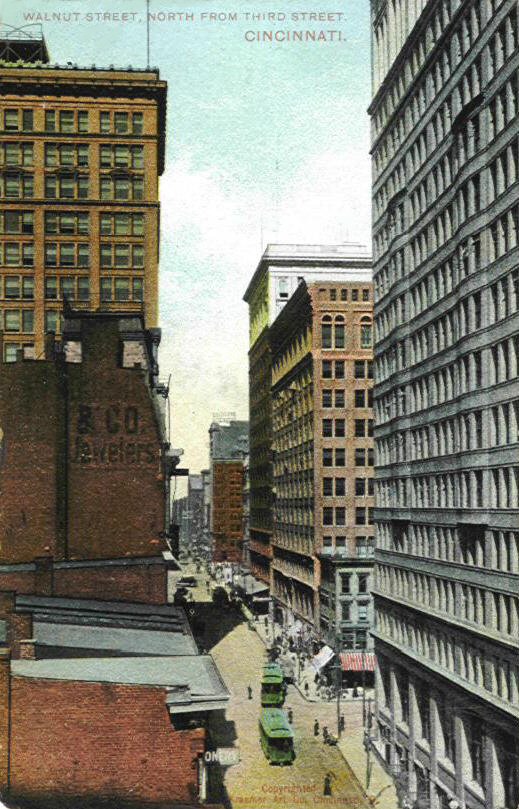
3 cards looking North on Walnut
Street from Third
3rd
Street
Some of the buildings you are looking at in the 3 Walnut Street cards above are the 1st National Bank Building which is the tallest building on the right side. Going north across 4th St. the next 12 story building is the Mercantile Library Building followed by the even taller Traction Building. Fifth Street and Government Square come next. On the left side starts out with the Dixie Terminal Building, Fourth Street, then on the north west corner is the Union Trust Building followed by the Gibson Hotel and then Fountain Square.
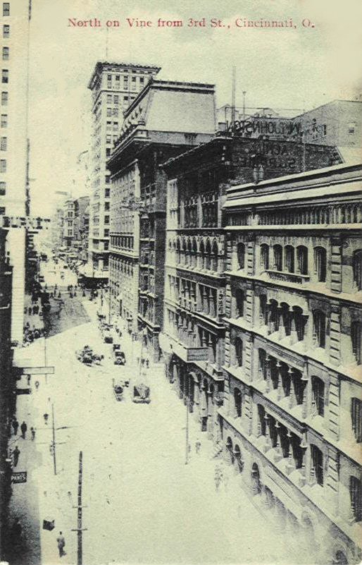
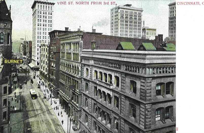
2 cards looking North on Vine Street from Third.
You can not see the left side of Vine Street on these 2 cards but what was located there at that time was the famous Burnet House (on top of which the photographer is standing) and later the Union Central Life Building which replaced it. Across 4th St. were the Stag Hotel, Emery Arcade, Emery Hotel and the Carew building, most of which were to be replaced by the Carew Tower. On the right side is the famous Sinton Hotel on the corner of 4th St. in front of the tallest building in these cards, the first reinforced concrete skyscraper in the world (1903), the 16 story Ingalls Building. Other structures on the other side were the Fountain Square Hotel, the Honig Hotel and on the corner of 5th St. the building referred to as the Wiggins block. Then, of course, was Fountain Square.
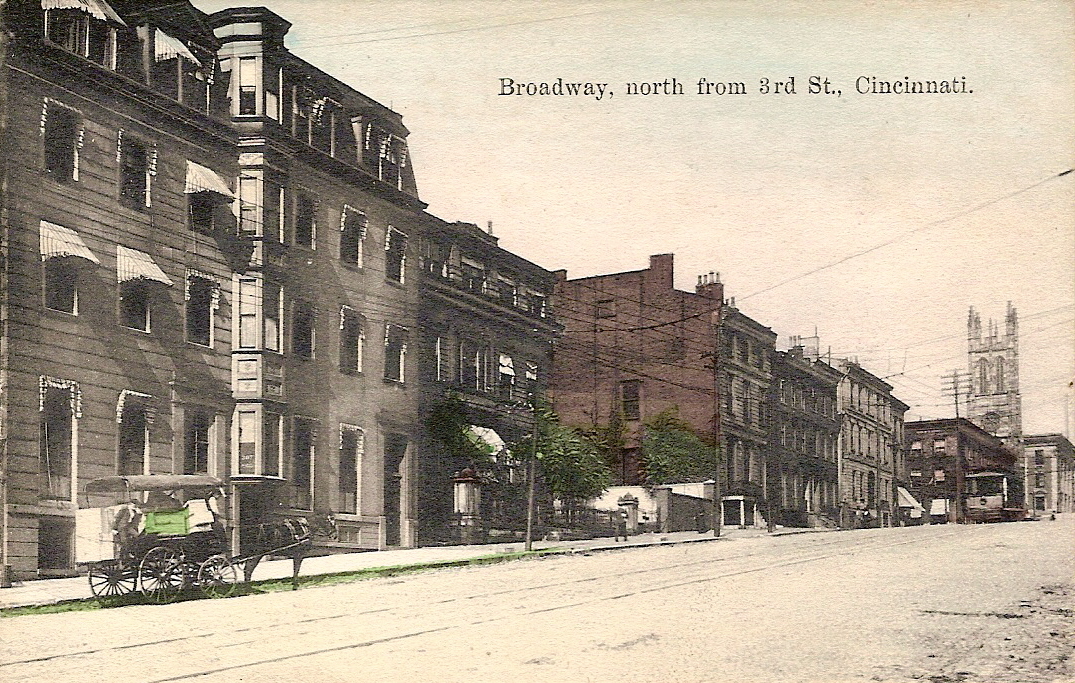
Some of the buildings seen in this card are: first building is the Anderson Hotel; next to it is the Colonial Hotel; on the corner of fourth is the Queen City Club; across the street is the Broadway Apts./Hotel and the tall tower in the distance is the Scottish Rite Cathedral.
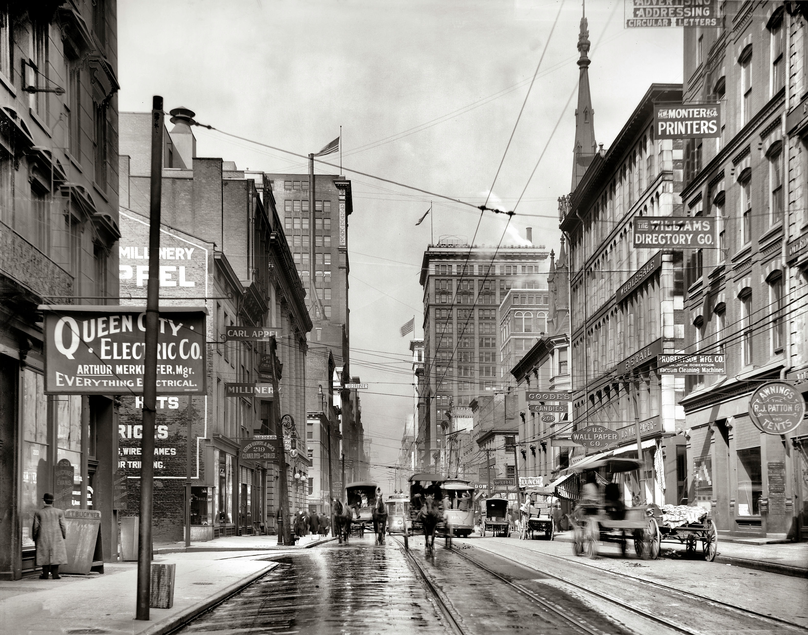
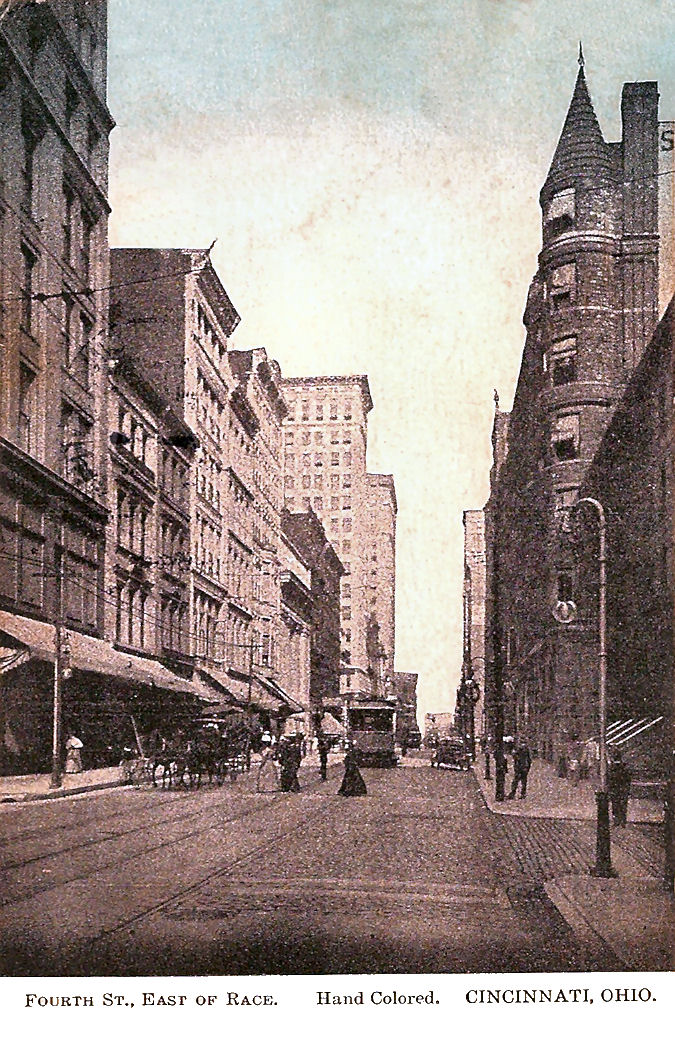
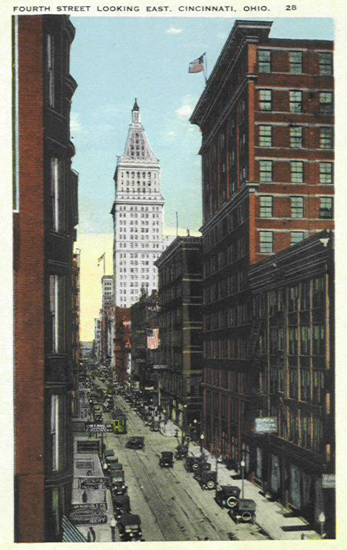
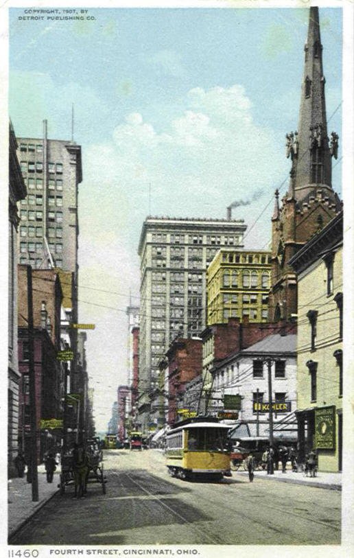
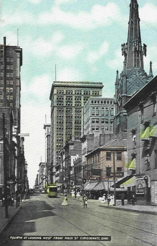
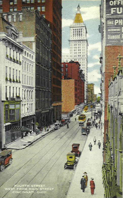
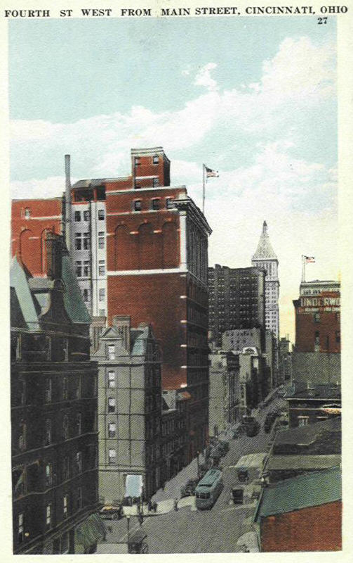
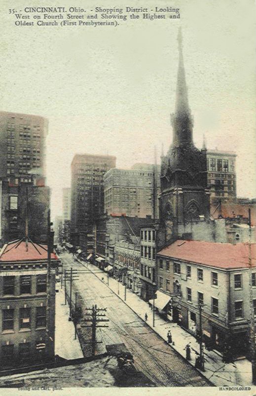
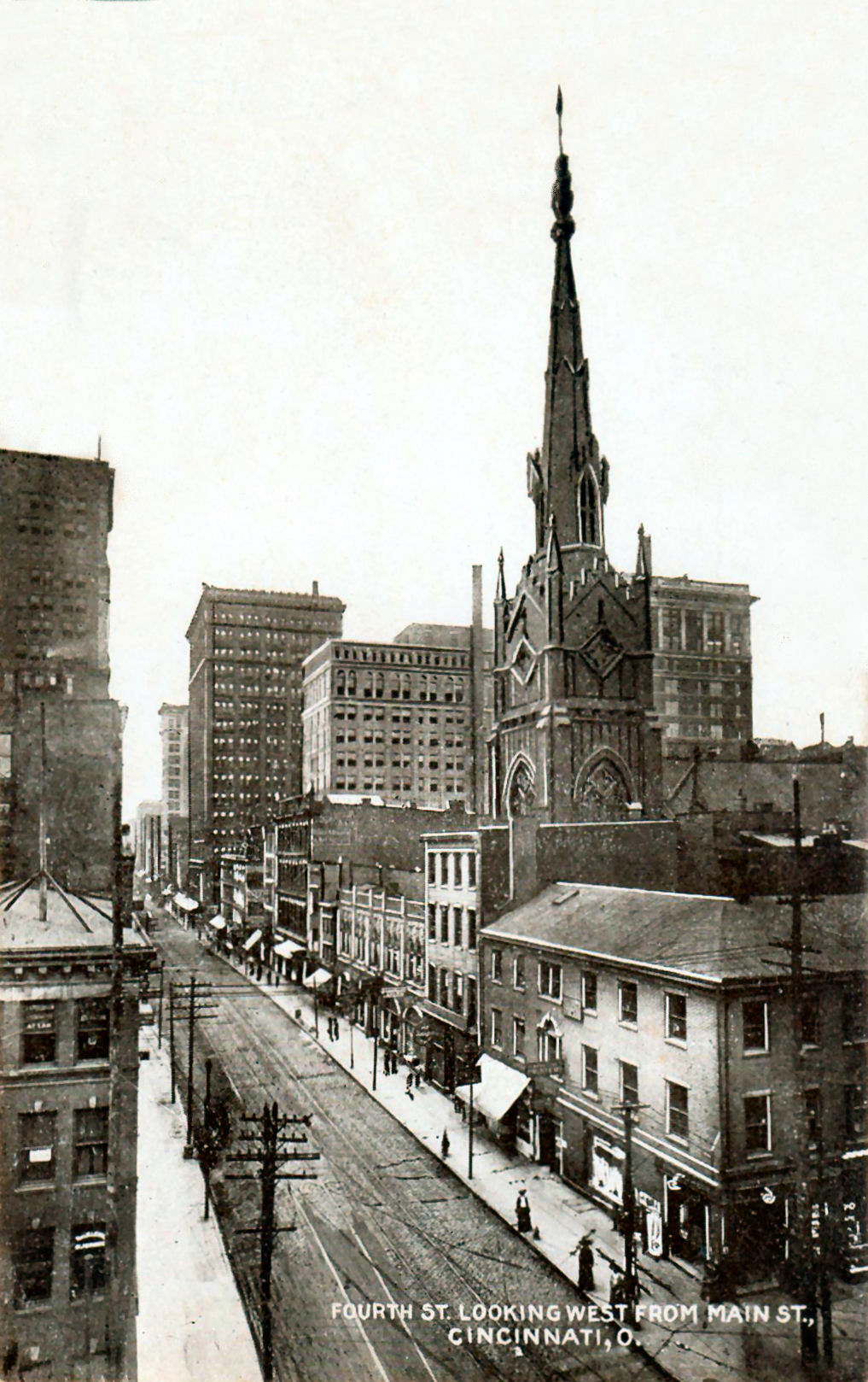
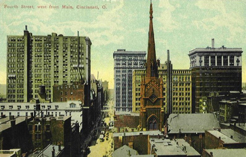
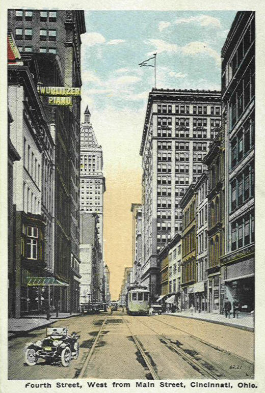
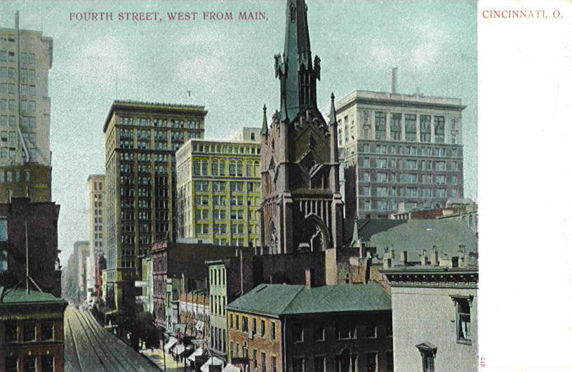
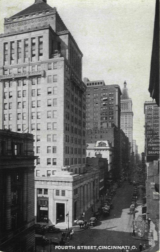
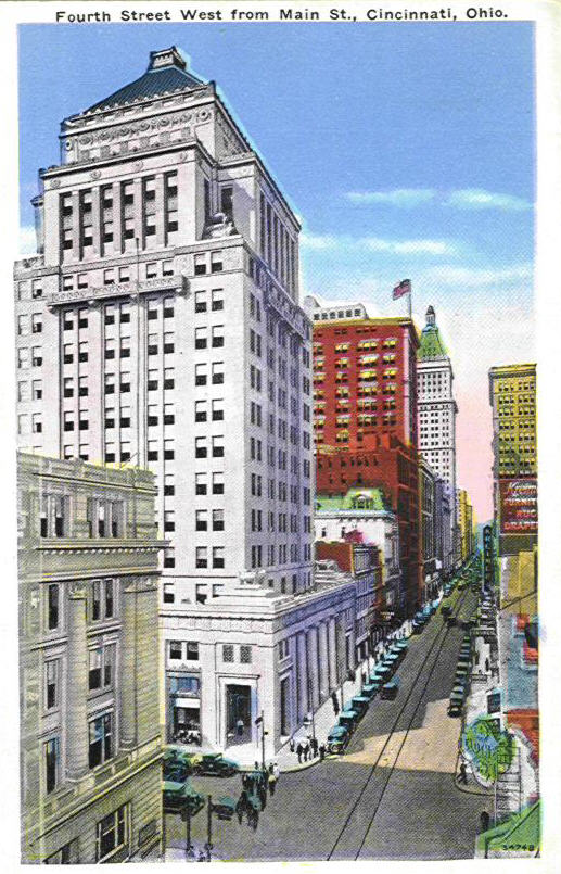
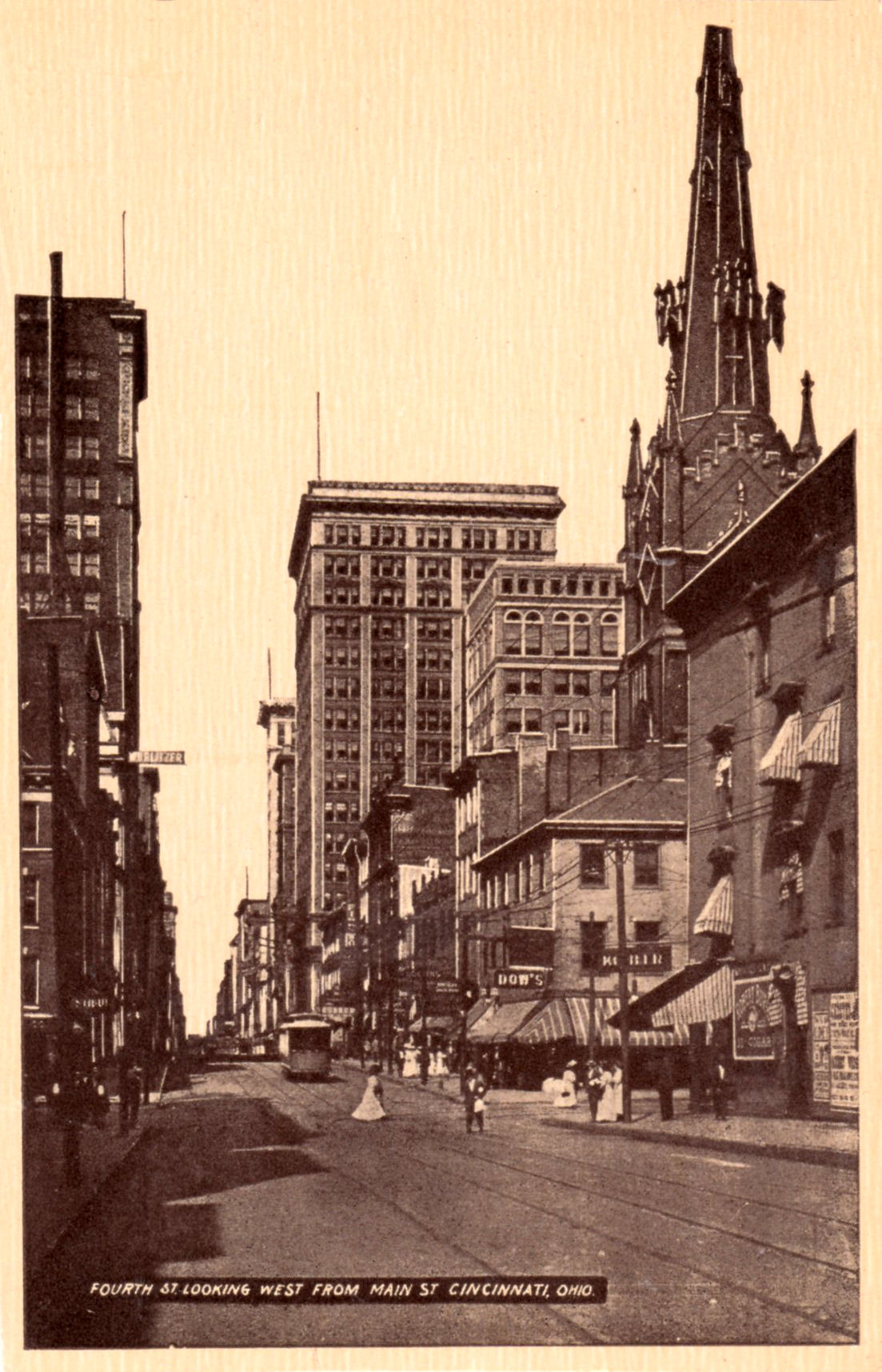
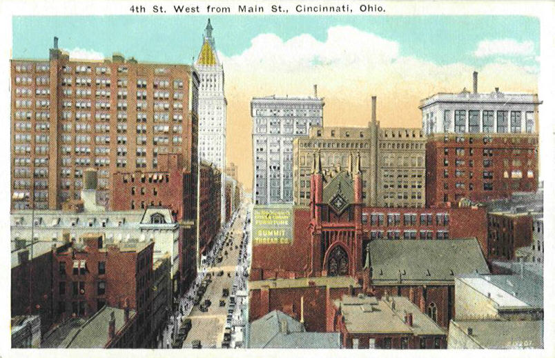
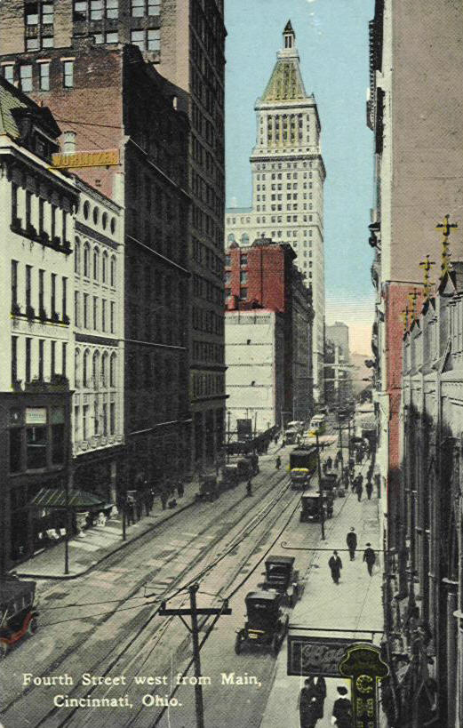
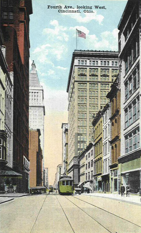
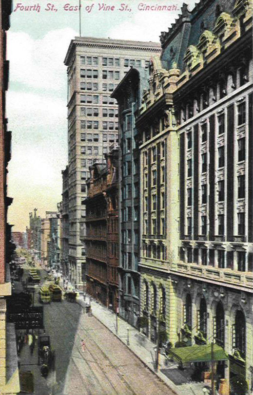
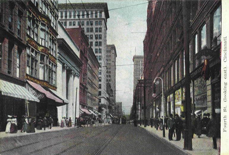
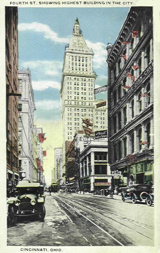
FOURTH STREET
I put the 5th card above up because of the clarity of the image compared to the colored version next to it, and it is slightly different.
1910 Photograph
The photograph is very large and clearly shows what is being seen in the postcards above and below
I added the second card above because it is what is called an error card in that it was improperly trimmed. The card is larger than it should be because there is not supposed to be a border around the image.
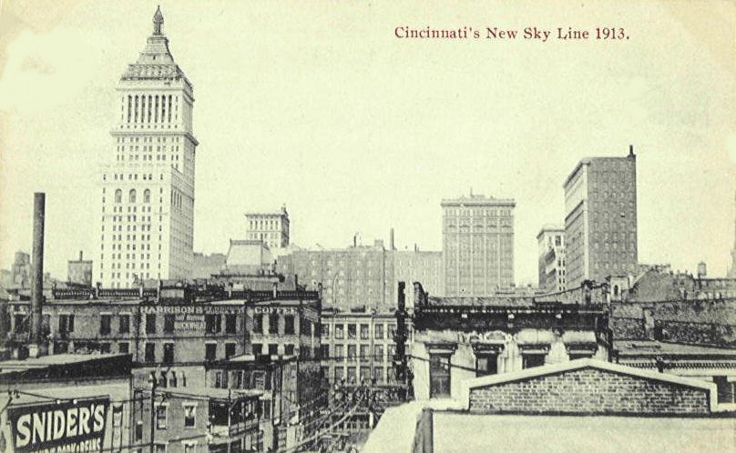
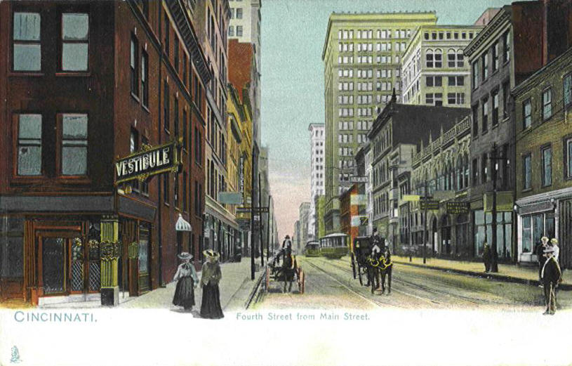
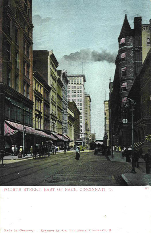
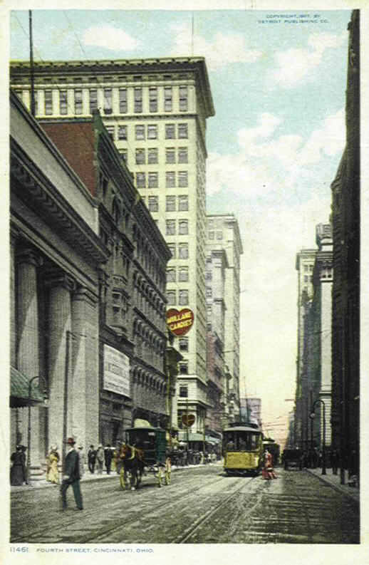
I will try and point out some of the more obvious buildings in the postcards above. The tall building with the pointy roof seen in the last two cards in the middle row is the Cincinnati Gas and Electric Building on the s.w. corner of 4th and Main erected in 1930 this helps date those two cards. The building to its left on the s.e. corner is the Citizens National Bank Building. You will not see this building in most of these cards for the simple reason being they were before it was constructed. To the right of this location was where the Wurlitzer Piano Building was located, the tall building further up the street is the First National Bank Building on the s.e. corner of 4th and Walnut, on the s.w. corner is the Dixie Terminal Bldg. The very tall pointed roof building in the distance is, of course, the Union Central skyscraper at 4th & Vine. Going to the north side of 4th Street we will start with the pointed spire tipped building seen in most of the first half of these cards. It is the First Presbyterian Church, the skyscraper to the right of the spire is the Traction Building on the s.e. corner of 5th and Walnut. The skyscraper to the left of the Traction Bldg. and on the left of the spire is the Mercantile Library Building and the skyscraper to the left of these two buildings is the Union Trust Building on the n.w. corner of 4th and Walnut. The skyscraper just barely seen behind this building is the Ingalls Building. All of these structures are still standing (I do not know about the Wurlitzer Building).
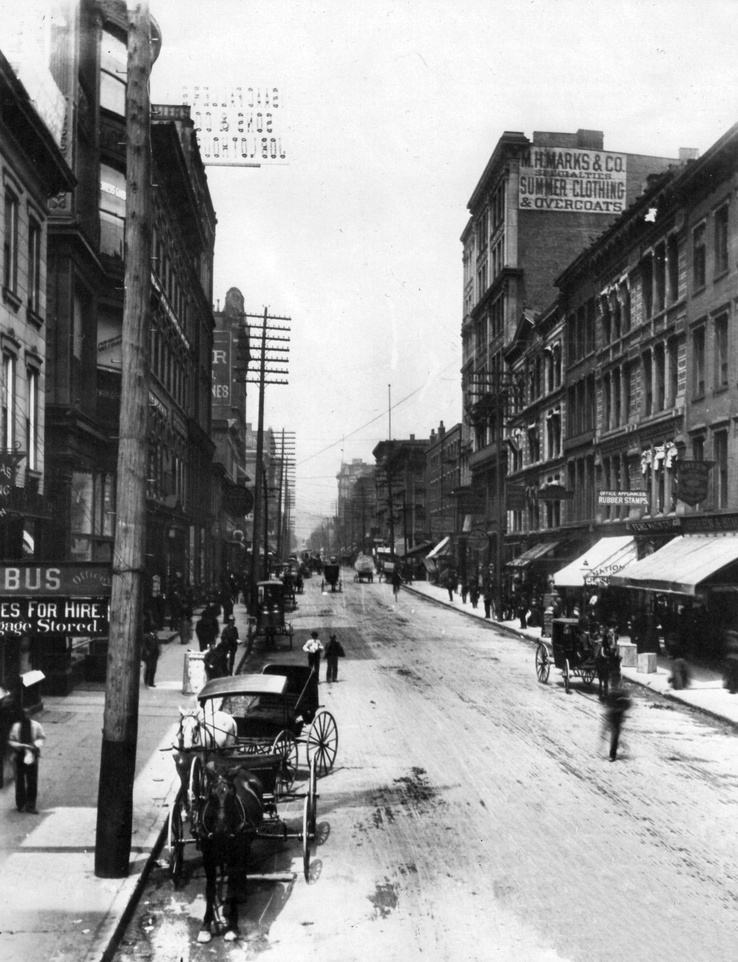
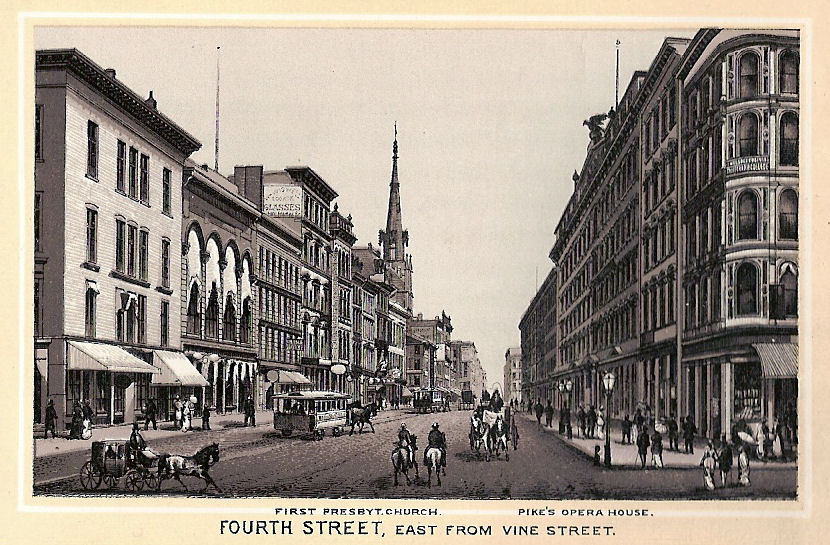
The first image is a rarely seen view of 4th Street east from Vine in the 1800s. A couple of buildings seen in the 2nd postcard are: The Sinton Hotel on the right at the s. e. corner of 4th and Vine; across the street and barely seen on the left is the Ingalls building; the tallest building on the right is the First National Bank building on the s. e. corner of 4th and Walnut; on the s. w. corner is the Dixie Terminal building. Years before this image Pike's Opera House used to stand in the middle of the south side of the block between Vine and Walnut and where a part of the Sinton Hotel stood.
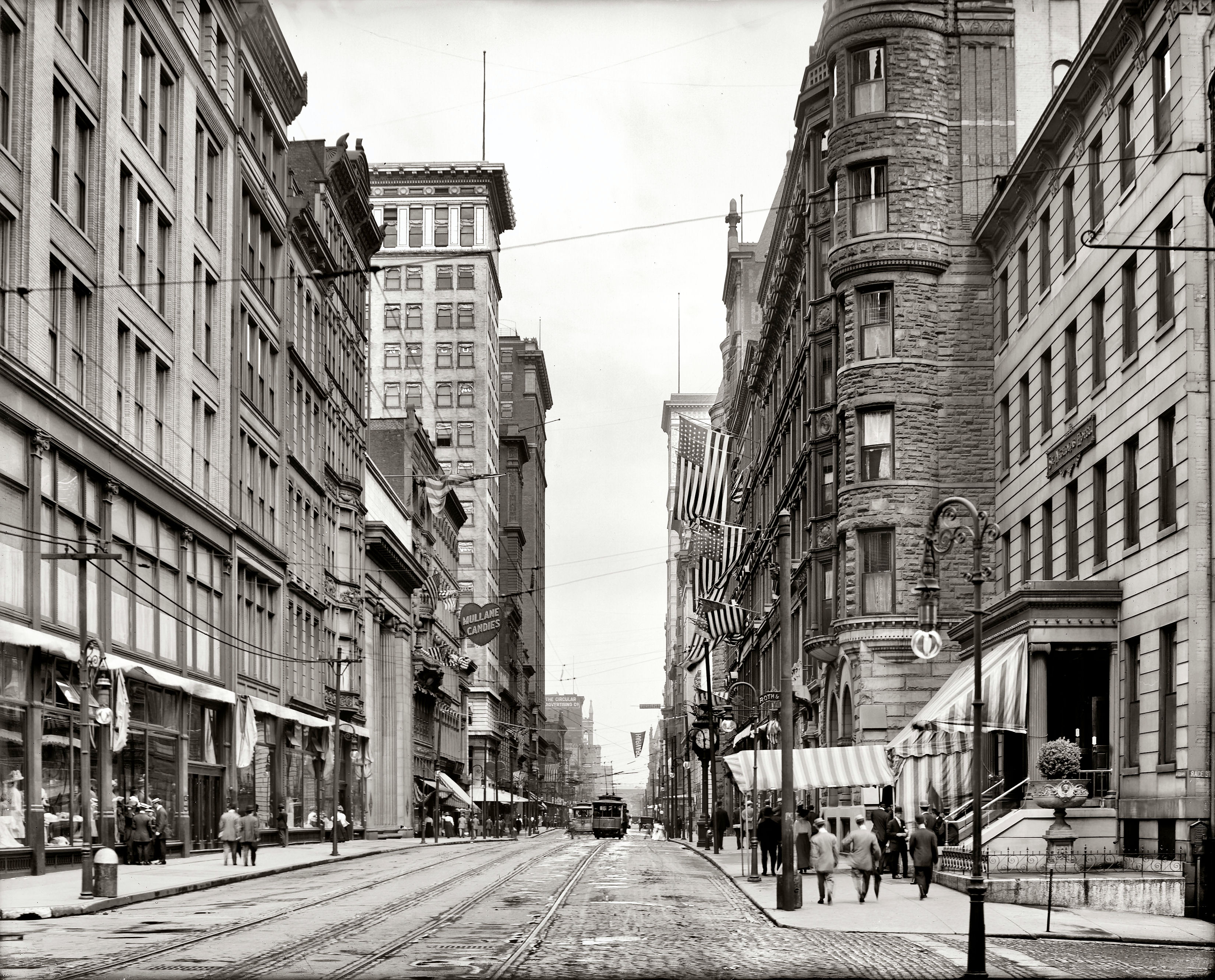
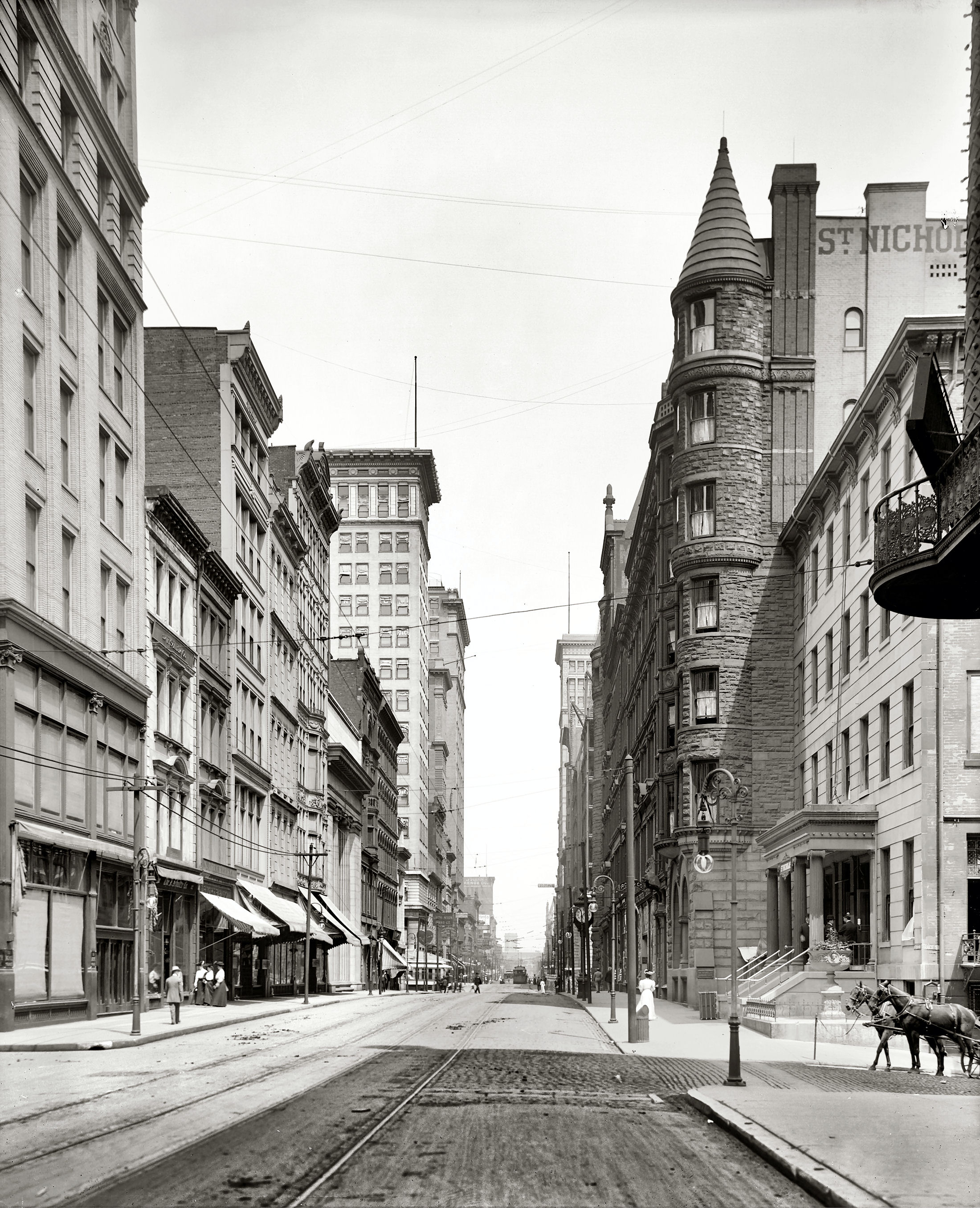
All five cards are from Race Street.
1910 Photographs
Photograph used
for
Compare with 2nd & 3rd
1st postcard
above
cards above
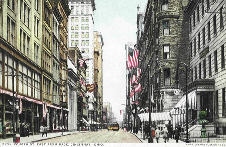
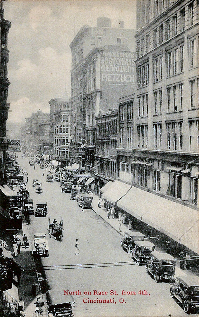
Of course as with all these cards the buildings mentioned may or may not be seen, it all depends on when the image was taken. Some of the buildings seen above are; on the north side of the street (left) tall skyscraper in distance is the Union Trust Building; The tallest skyscraper is the Ingalls Building; the Third National Bank is the building in the middle of the block with columns. The building that has a heart in front, across Vine St. from the Ingalls Building was the John Mullane Co. a candy maker. The Pogue Dept. Store is the first building on the left. On the south side of Fourth (right) the first building you see in the first card was the St. Nicholas Hotel. The tall skyscraper in the distance is the First National Bank on the s. e. corner of Walnut, barely seen in front of it is the Sinton Hotel on the s. e. corner of Vine and on the s. w. corner of Vine is the location of several important buildings in Cincinnati's history. This was the location of Cincinnati's Main Post Office before it was torn down and moved to 5th Street and Government Square. The Building that replaced it was the Chamber of Commerce Building which burned down. The new Chamber of Commerce building was constructed down the street at the s. w. corner of Fourth and Race, to the right of where these photographers were standing. The third and, so far, final building on this site is the famous Union Central Building. In the foreground on the right is where McAlpins was.
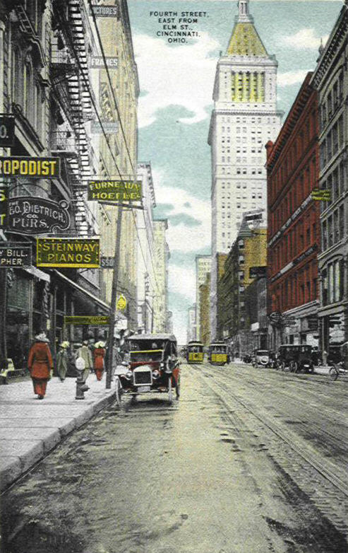
The large building on the right was the John Church Co. a piano maker, dealer and music publisher. Across the street you can see the Steinway and Sons store, another piano maker and dealer and next to them you can see the Furneaux-Hoelle Co. a millinery store. You can also see a sign for the Theo. Dietrich Co., fur manufacturers. Of course all the buildings already mentioned can, more or less, be seen.
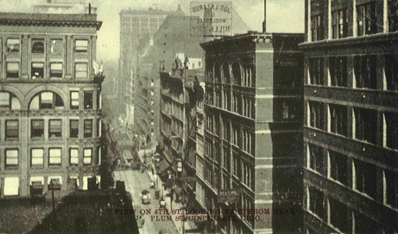
From
Plum
The 2nd image above is a photograph.
FOR MORE OF THE SAME ![]()
