The four large postcards below show half of the famous panorama taken of the riverfront east to the bend in the Ohio River. I have become rather fanatical about this set of eight photographs and , as a result, I have included the complete set below. These are very large and the best looking set yet produced. You can, of course, use the explanations for the four postcard versions on the first four images of this set also. When time permits I hope to do the same thing on the last four. I repeat these are very large so be patient.
If you wish to see the entire panorama: ![]() Hit backspace to return.
Hit backspace to return.


1st Image: The foot of Main Street is seen at right-center. The foot of Walnut Street is above the steamer Wave. The buildings to the left of Main St. were known as Sausage Row because of all the Irish that moved in there. It was earlier known as Bratwurst Row because of all the German settlers that lived there. Steamboats seen are Lancaster, Wave, Colorado, Highland, Mary No. 2 and The Doctor Franklin No. 2. 2nd Image: The church in the center is the Second Presbyterian Church between Vine & Race. The area in the right foreground was known as Cassilly's Row. Today it is the location of Great American Ball Park & US Bank Arena. Steamboats seen are the General Worth, Embassy, and Car of Commerce. 3rd Image: Christ Church is in the background. Ludlow is the street at the left. Today this area is Yeatmans Cove. The packet Brooklyn is docked along side a steamboat that is under construction. 4th Image: Lawrence Street is left-center (this street only exists today as a one block street near Lytle Park). The steamboats seen are the John Hancock, The Alexander Scott and the Meteor.


Plate
1
Plate
2
Plate
3
Plate 4


Plate
5
Plate
6
Plate
7
Plate 8
The importance of the Ohio River in the life of Cincinnati can be compared to the arteries in your body. The Ohio was the life blood of Cincinnati in its first 100+ years and kept it thriving. The arrival of the railroad of course lessened its importance to a large degree but it still remains a vital path for goods essential to the growth of this country. The riverfront has been the focal point of all this activity ever since the city sprang up out of the wilderness. Here are a few pieces of trivia to demonstrate the importance of the public landing, which is that part of the riverfront which is directly between the Ohio River and downtown Cincinnati:
In 1829 nearly 500 steamboats arrived at the public landing.
You could find as many as 40 steamboats at a time docked at the landing by 1840.
In 1852 there were 8000 recorded arrivals, which works out to 1 steamboat arriving every hour.
By the end of the Civil War, 1,000,000 passengers and 2,500,000 tons of freight were annually transported on the Ohio River.
By 1900 these figures rose to 4,000,000 passengers and 14,000,000 tons of freight.
In comparison, in 1910, 245.2 million tons of freight was moved. Of course in these days passenger travel is nil.

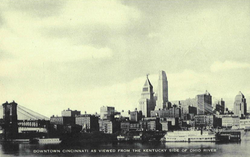
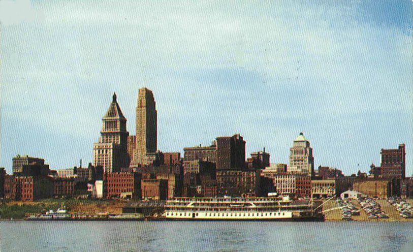
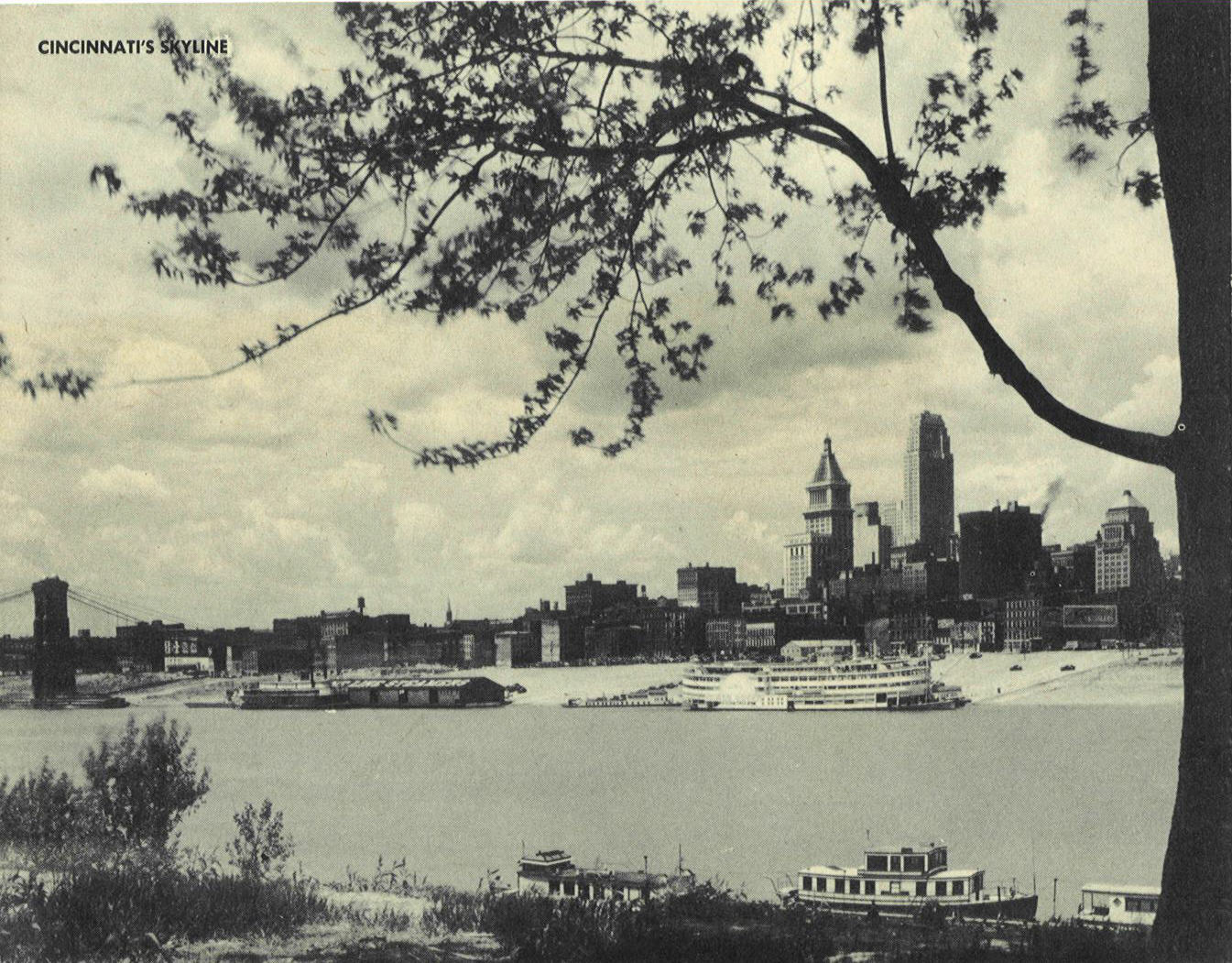
Skyline in late 20s
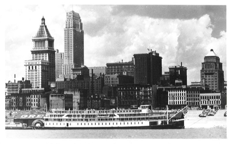
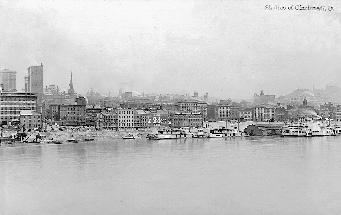
You will see many cards below showing the skyline of Cincinnati. I thought it might be a good idea to name some of the major buildings that you will be looking at. In the non-postcard photo above you can see the Island Maid getting ready to make a landing next to the steamer Cincinnati. Looking left to right you can see the Union Central building, the Carew Tower, the Union Trust, the First National Bank, the Traction building, the Union Gas & Electric, the old telephone building, Christ Church and on the extreme right edge you can see the old Spencer House.
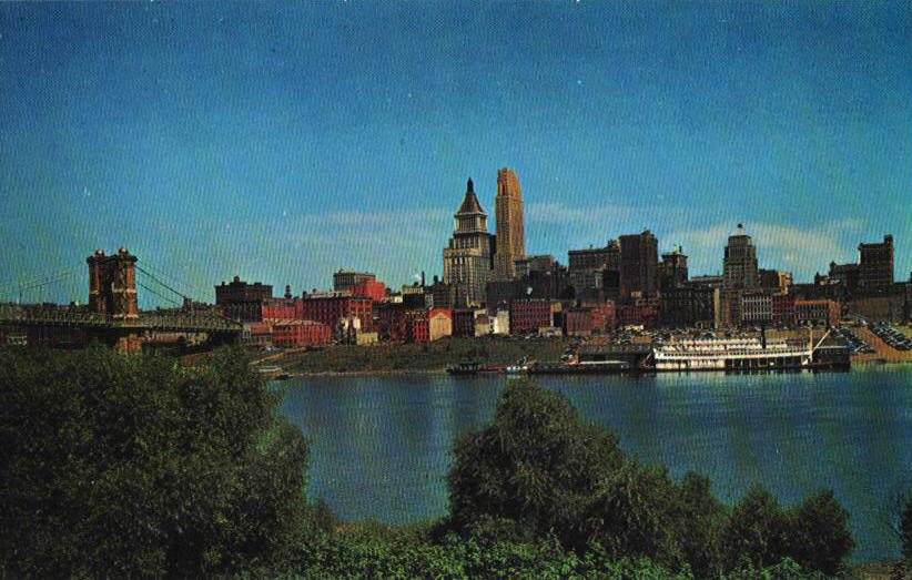
These 9 cards show the area west (down river) of the Suspension Bridge.


a REALLY retouched
image


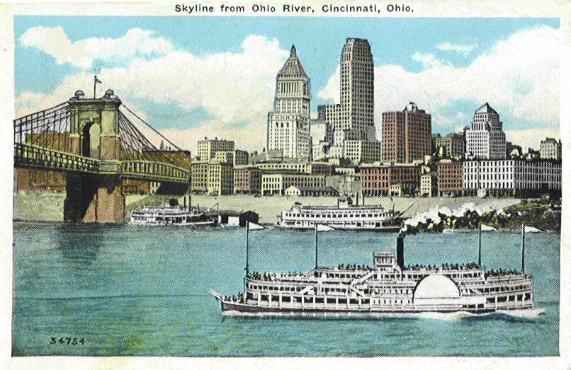
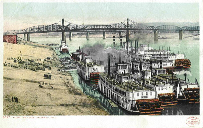
The cards below show the public landing and the area around as seen from the Kentucky shore line, the Suspension Bridge, and from the Cincinnati shore. Something to watch for: steamboats always docked facing up-stream.


Postcard and original photograph


The same steamboat is drawn into the three center cards.


Real Photo view from
Newport, KY

Covington, Ky. From
Riverfront


Real
Photo
Same image


A very rare view on a
Three real photo postcards
PMC mailed in June 1899


Rare Private Mailing Card


1904 Photograph
The 2nd image above is of the public landing in the 1890s. In the foreground is the last of the Telegraphs belonging to the Louisville and Cincinnati Packet Co. In the lower right corner is either the Congo or the Carrolton, sister boats of the Telegraph. You can always tell which boats belonged to the Louisville and Cincinnati Packet Co. by the double white stripes on their smokestacks. Out in the river, the City of Louisville is in tow of the Hercules Carrel. In the 3rd card from left to right are the Peters Lee, Island Queen, Princess, and City of Cincinnati. The photograph is the one used for the 2nd image and you can see that the first boat is the Tacoma and the 3rd boat on the right is the towboat Hercules Carrel.


1914 Riverfront from
Suspension Bridge (Same Image)


Same image


Very rare Real Photo
PC
The 2 Conoco cards above were produced by the Conoco
Oil Company and were available at all the Conoco Service Stations around the
country. You notice I said "Service Station" instead of gasoline
station. In the pre-war years up to the 70s, gasoline stations were actually
fighting to win your loyalty. Gasoline stations were actually manned by
attendants that "serviced" your car quickly and in a friendly manner.
The Touraide was Conoco's way of winning you over to their gas. The Touraide was
a set of personalized maps plotting the best or most scenic route for a family
vacation. Instead of having a huge map that you had to constantly fold and
re-fold you were sent a customized spiral-bound travel directory. The pages of
this book contained portions of road maps showing the route of your trip, which
was highlighted, to and from your destination. It also contained information
about roadside attractions, motels, road conditions, and of course the location
of the next Conoco Station.
You got your Touraide by sending in the route you wanted to take on
a postcard and whether you wanted to take the "quickest" way or the
"Scenic" route. If you wanted both each route would be highlighted in
its own color. This was all free.
7" x 9" Jumbo card


Photograph
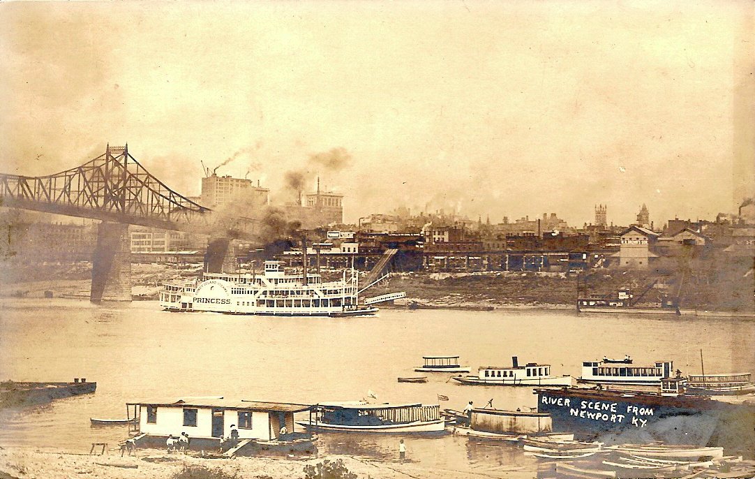
This is shanty Town which was on the east side of the mouth of the Mill Creek. To see more of Shanty Town, go to the Flood and Ice Gorge page in the Disasters section.
Oh! for the life of a shantyboat
man
Just doing the least that he possibly
can
He floats down the current-the rivers his
life
A dog, an old stove, yeah! an maybe a
wife;
Some canned goods, some books-a philosopher he
Content to live simply; just letting things
be
Aspiring to nothing within his short
span
Oh! for the life of a shantyboat
man.
W. J.
Levine

Sawyer Point